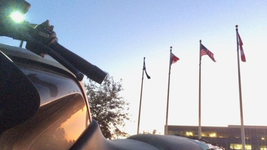
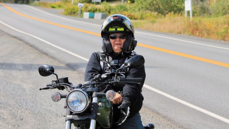
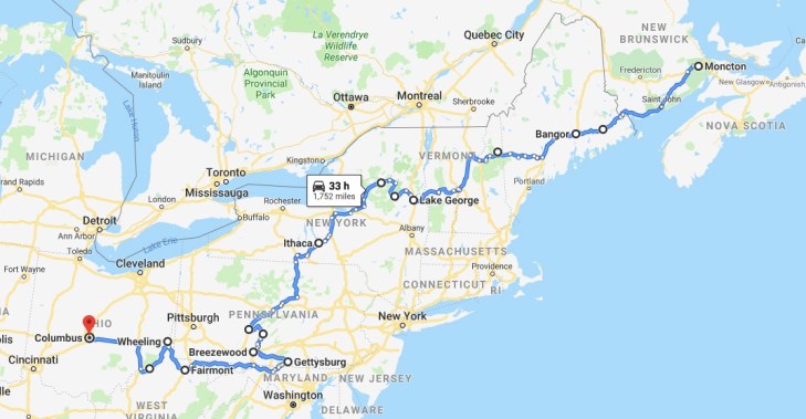
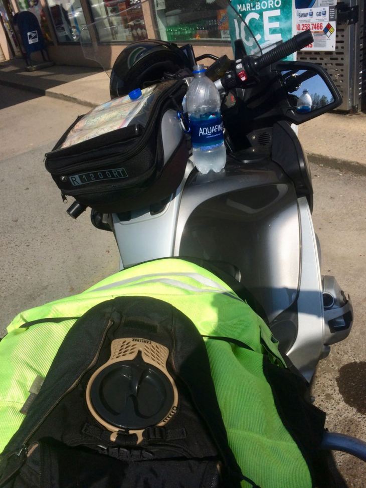
I embarked on this 8,984 mile solo motorcycle adventure on September 11th, 2019. I returned 29 days later.
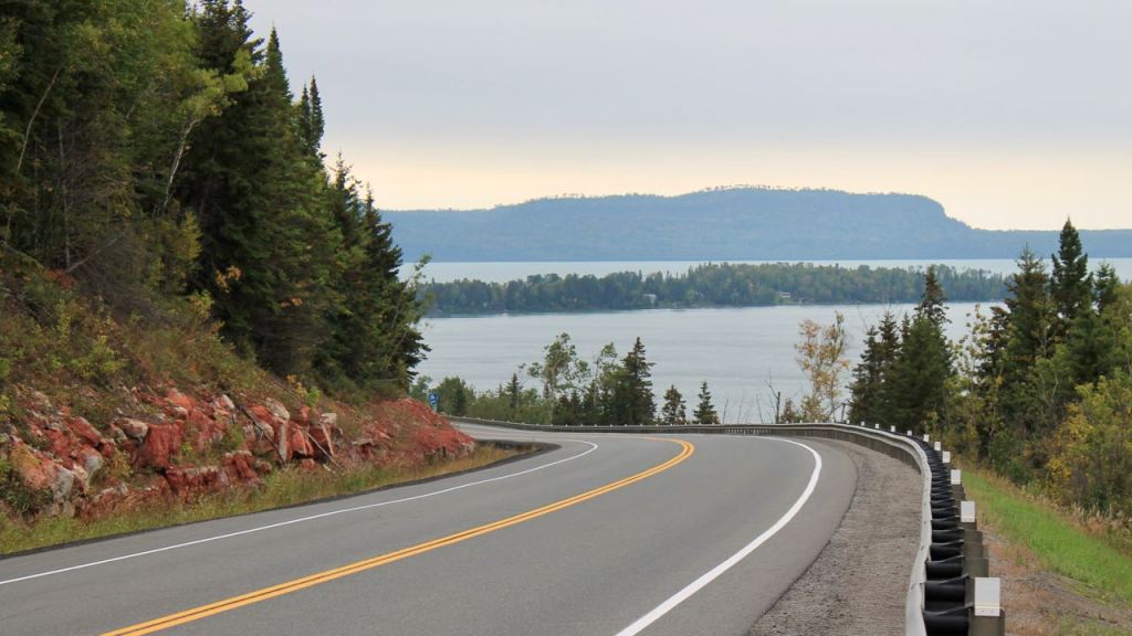
The first phase lasted 14 days. This part of the ride took me across Canada from British Columbia to Nova Scotia, culminating in a ride around the Cabot Trail.
In phase II, I took seven days to ride some scenic back roads through the White and Adirondack Mountains of the northeastern United States, arriving at Columbus during record high temperatures for a scheduled service stop.
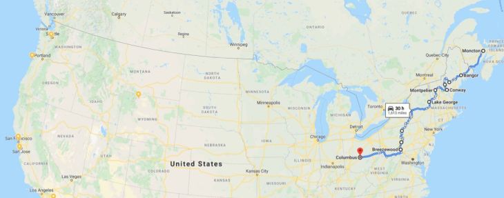
Phase III saw me take the interstate highway system from Columbus, Ohio to Seattle, Washington, getting home from Columbus in just six days, experiencing the end of a midwest heat wave followed by a northwest cold front.

An epic motorcycle adventure, to be sure. My fastest trip to the east coast yet, I cross off some of Canada’s most scenic roads from my bucket list.
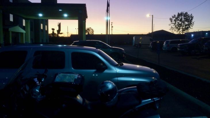
Day 1
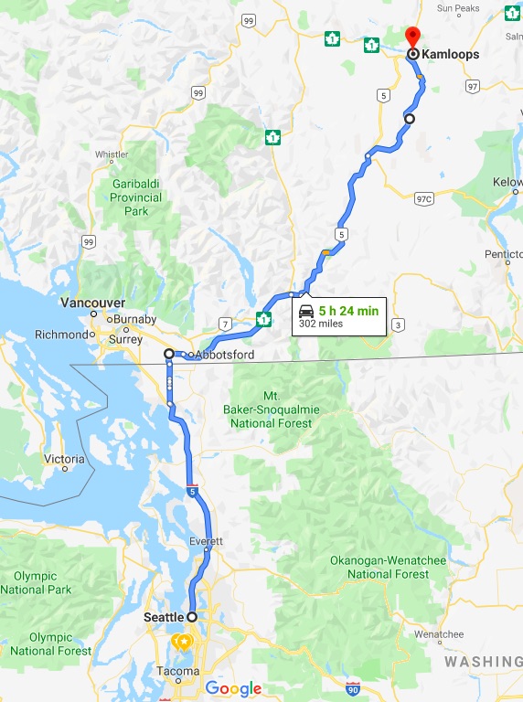
Day’s distance: 301 miles
The day started a little after 8am.

Temperatures started in the low 60s with some cloud cover, but it was a day of varied conditions.
After my latte stop near Burlington, the temperature and cloud cover dropped. It didn’t rain but drops of water accumulated on my visor and windscreen from the mist and fog. As I continued through the Skagit Valley, it cleared up again. This pattern would repeat itself again later in the day.
I used the Lynden–Aldergrove Border Crossing. When I arrived, there was no wait. I pulled right up and was asked only three questions. I didn’t have to remove my helmet and was finished and on my way again in under one minute – easily the fastest border crossing I’ve ever experienced.
Heading north from Aldergrove, my GPS was telling me to take Hwy 1 west. I knew that was wrong and turned east towards Hope, BC. The GPS quickly recalculated and we were once again in sync. Sometimes I think my GPS is completely retarded. 🙂
From Hwy 1, I took Hwy 5 north and headed into the mountains. I could see the clouds get darker and soon was in the mist. At the Coquihalla Summit, elevation 4,081 feet, it was raining off and on and the temperature had dropped to 51.

For years, I’ve considered the speed limits in British Columbia to be some of the most conservative. But today, on Hwy 5, the limit was often 120 kph, or 75mph. That was clearly not conservative and, given the conditions, I ended up doing about 65mph most of the time.
Once out of the higher elevations, the temperatures warmed up again. I stopped for fuel and lunch in Merritt, a small town about 60 miles south of Kamloops.
I paid 1.43CAD per liter of fuel for 89 octane. That works out to about $4.11/gallon. Compare that to the 92 octane I filled up with earlier near Burlington that cost $3.19. In Seattle, I usually end up paying somewhere around $3.85/gal, not much different than in Merritt.
From Merritt, instead of staying on Hwy 5, the main thoroughfare to Kamloops, I chose to take Hwy 5A, one of the roads I traveled this spring on my ride to Desolation Sound. It’s a two lane road with virtually no traffic -my kind of road.

Just prior to reaching Kamloops, I came across a traffic safety stop. The primary reason for the stop was to have large trucks check their brakes before proceeding down the steep hill into town. I was surprised when I was given the signal to stop by the safety officer.
I was initially asked to show my license, but the guy quickly said that since I was on a BMW and he rode BMWs, I didn’t have to bother digging it out of my pocket. We talked about riding and motorcycles for roughly 5 minutes before any other cars showed up and he had to get back to work.
That was likely the most enjoyable traffic stop ever. Along with the quickest border crossing, this was turning out to be a day of “best-evers.”
I arrived at my hotel before 4pm. I worked out in the gym and took a quick swim in the pool. One of my goals on this trip is to incorporate stretching and working out into my travel. I’ve been working with my trainer for a year now with great results. I don’t want to lose ground because I’m on the road.
Tomorrow, I head up into the Canadian Rockies. I’m looking forward to the ride!
Day 2
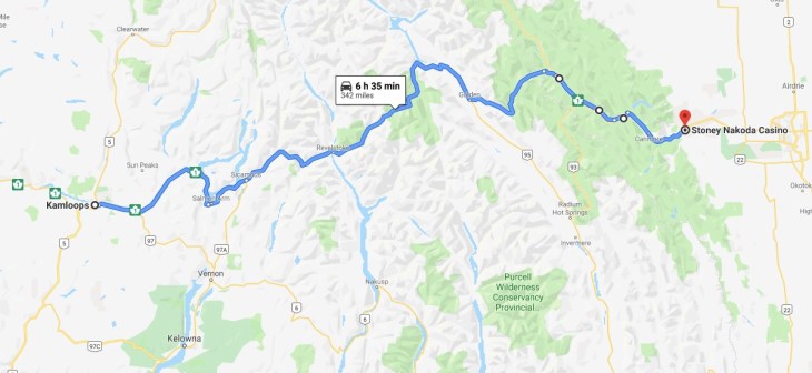
Day’s distance / Total trip distance: 342 miles / 643 miles
I woke up way early and couldn’t get back to sleep. So I was one of the first hotel guests downstairs for breakfast at 6am. I was happy to see it was dry outside and relatively warm, a temperature of 55.
The Weather Channel was on the TV in the breakfast area. The channel seems to highlight the most extreme weather anywhere on the planet in a highly dramatized way. I don’t normally watch it and don’t plan to do so regularly.
I bring it up because Nova Scotia was impacted by the hurricane Dorian last weekend. I’ll have to dig into that issue a little further in the days to come.
The bike was packed and I was on the road by about 7:30. An early start was almost a requirement today, as I had a longer day in the saddle and I lost an hour with the timezone change.
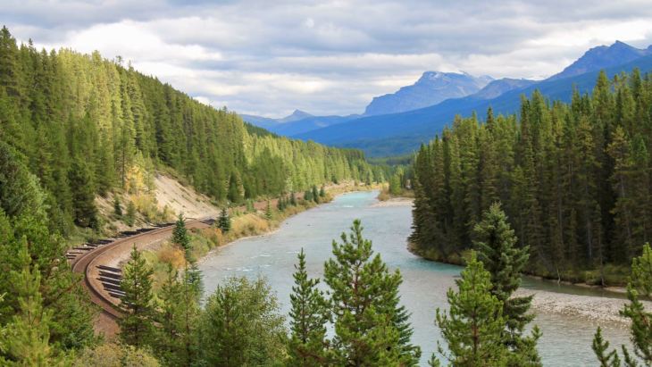
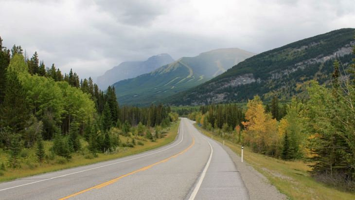
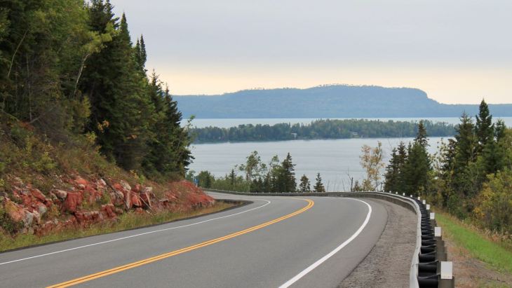
Much of the day was spent on Hwy 1, aka the Trans-Canada Highway. At times, it was one lane each way with an occasional passing lane while at other times it is a two-lane divided highway. There was a pretty steady mix of construction sites along the way today.
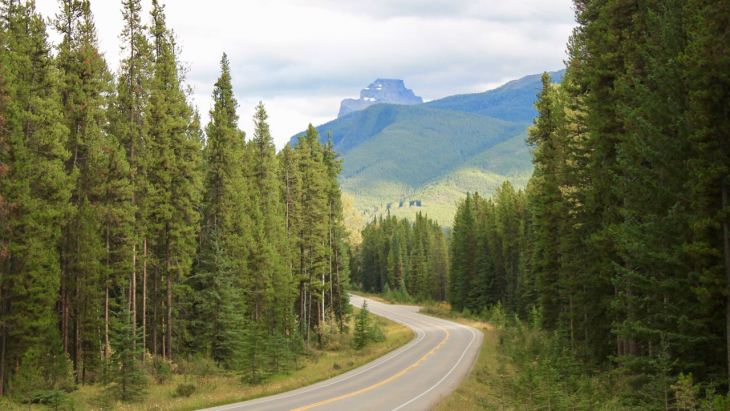
I took the photo below about an hour east of Kamloops.
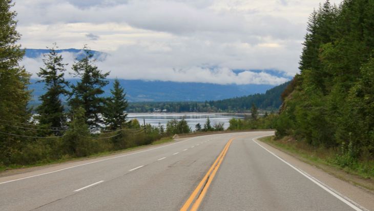
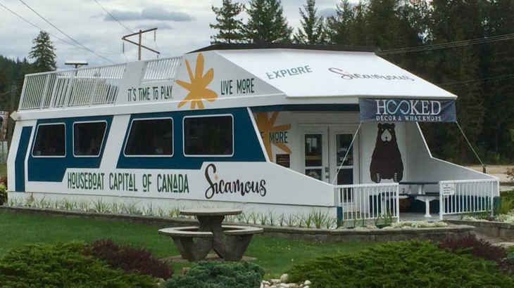
The stretch of highway between Kamloops and Revelstoke was new to me. I passed through many small(er) town, like Sicamous, known as the houseboat capital of Canada!
Honestly, I probably would not have noticed except there is a public rest area toilet just out of frame. The coffee I had earlier was really going through me. 🙂
There was a significant construction delay getting into Revelstoke, where I stopped for fuel and second breakfast. I was last in Revelstoke on my ride to Alaska last year. The weather was a little bit drier today, but as cool and cloudy as that day in June. I was told by a resident that it does, on occasion get sunny there. <yeah, right>
Continuing along now familiar roads, I traveled through Golden without stopping, making my way to Lake Louise by about 4pm, local time.
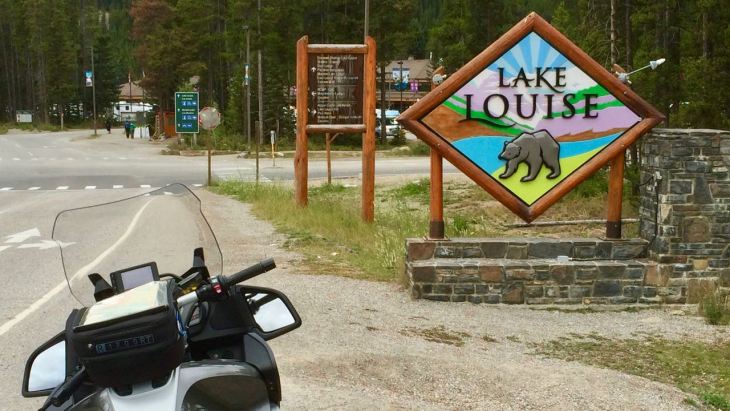
Topping off with fuel once more, I grabbed some trail mix and eventually made my way to the Visitor’s Center to grab a day pass for the Bow Valley Parkway, part of the Banff National Park.
I debated getting an annual pass, given I was going to see a lot of Canada on this trip. It would make sense though only if I spent more than seven days total in the parks. I didn’t think I would – we’ll see.
The Bow Valley Parkway, Hwy 1A, parallels Hwy 1 but has little traffic and slow speed limits. I found it very relaxing.
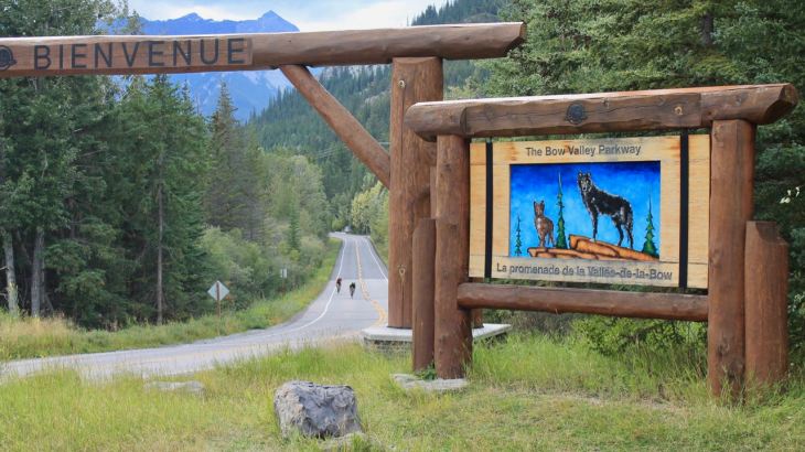
It was scenic, as well.
By the time I had completed the hour-long Parkway ride, it was 5:30, so I skipped a tour of Banff and traveled past directly to my hotel for the night.
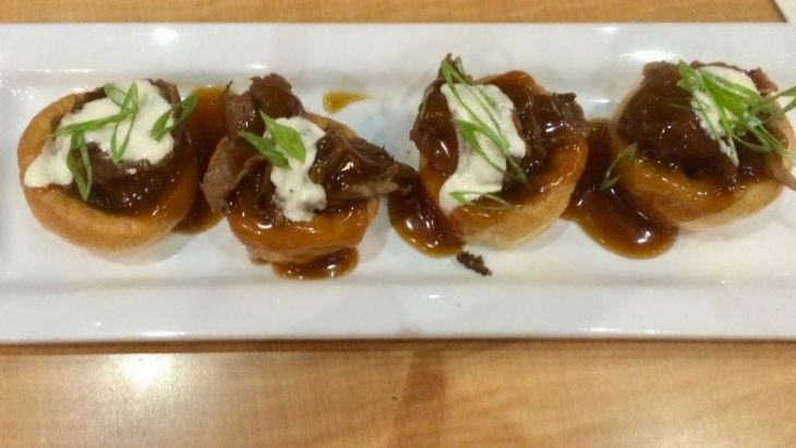
I had a light dinner, really just an appetizer and a beer. I chose to try the Prime Rib Yorkies, which I discovered were mini Yorkshire puddings stuffed with roast beef and horseradish. Delicious!
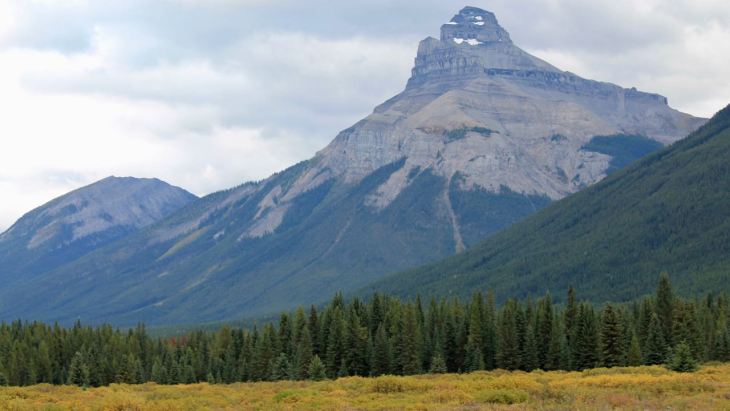
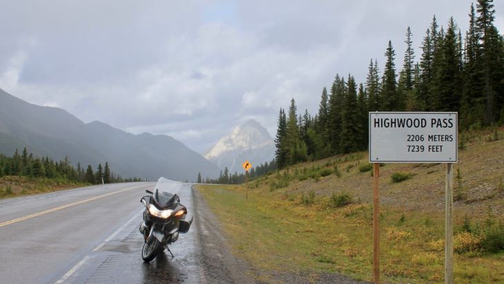
Tomorrow I ride over Highwood Pass, the highest paved road in Canada, on my way to Medicine Hat. Woo hoo!
Day 3

Day’s distance / Total distance – 291 miles / 934 miles
When I left the hotel, it was 55 with high clouds. It was a beautiful morning.

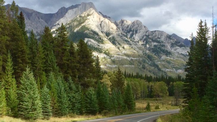
The hotel is located on Hwy 40, the beginning of the Kananaskis Trail over the Highwood Pass.
It was about 9:30 when I left the Stoney Nakoda Resort. I had a great discussion with the hotel manager, Lino Toppazzini, about my stay. He is well-spoken, considerate and, on top of that, rides. We talked about motorcycles and a huge rally that the hotel supported.
I would stay there again anytime I was traveling along the Kananaskis Trail.
Almost immediately I knew I would like this highway.

While it was dry at this point, later it would begin to shower. I took photos while I could. Here are some of the highlights.
The road surface was very wet at the summit.
I stopped to put on my rain layer, when I noticed three bears across the highway. Before I could get the camera ready, two ducked out of sight. I managed to capture the third before a truck came along and scared them off.

It’s always exciting to see wildlife so close, and in the wild.
With rain gear on, I continued down the south side of the pass.

The Kananaskis Trail is roughly 100 miles and, if traveling south you end up in Longview, AB. I fueled up there (super inexpensive gas!) and continued on my way to Medicine Hat.
The scenery changed to low hills and farm land.

As the day worn on, the geography became flatter and the winds stronger. Welcome to the plains.
The temperature at this point was 75. I stopped to take off my mid-layer and stretch my legs.
I arrived in Medicine Hat about 4:30 local time. An early arrival gave me time to workout before choosing to eat at the Rustic Kitchen. I had the North Fork Ranch Elk Ribeye with a Saskatoon Berry Port reduction.

I had a bite out of one of the aged white-cheddar perogies before I remembered to take a photo <oops>. Everything was locally sourced and super yummy..
Another great day. Tomorrow I continue down the Trans-Canada Highway to Regina. I expect no precipitation and strong winds.
I live a charmed life <eh> 🙂
One note for travelers in Canada
Canadian businesses use a small, sometimes handheld machine to process credit card purchases. If the processor gives you the option of converting the bill into the consumers ‘home currency’, don’t do it. They add a 4% fee for the conversion. It’s the ultimate in sleezy business practices.
The hotel processor last night offered me that option and it wasn’t until I examined the conversion myself that I realized a fee had been added. The hotel manager double checked with me this morning (because he didn’t know) and confirmed the added fee. I was provided a generous credit back to my card. Very cool, Lino – thanks, again.
Most credit cards these days, including both the cards I carry, convert purchases in a foreign currency at no charge.
Day 4

Day’s distance / Total distance – 284 miles / 1,218 miles
Weather-wise, it was a beautiful day. The temperature when I first got on the bike was 55, but was in the 60s within an hour of my leaving the motel and reach the mid-70s this afternoon. The winds were traveling east with me and were not a bother, at all.
I crossed into Saskatchewan this morning.
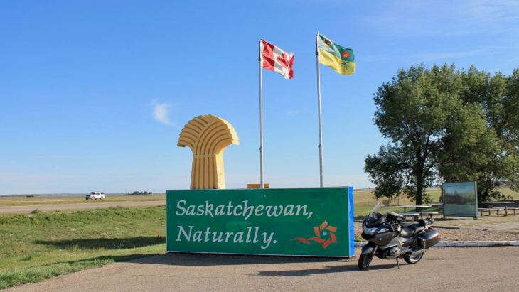
This is a first for both me and the motorcycle. I get to cross this province off my bucket list now. 🙂
Today was a relatively short. Although I traveled almost 300 miles, it was all along the Trans-Canada Highway. Flat prairie land, cattle ranches, large farms, and wind generators on the low hills were all common and I didn’t have the creative energy to take many photos. My excuse – the open space is hard to capture in a photo.
Other than fuel, my only stop was a Starbucks located in the Town n’ Country Mall, inside a drugstore.

While there, I spoke with a few people who asked about my travels and/or the motorcycle. I have to say, the folks here are friendly and curious – I love it.
Since I arrived at my hotel pretty early today, I was able to get in a workout and a swim before Happy Hour at the hotel’s English Pub.
Tomorrow I travel to Winnipeg. It will be a longer day by about 90 minutes so I’ll get started by 8am. More prairie land so I can’t promise great photos but I’ll try to be a little more creative. Stay tuned!
Watch out for cameras enforcing speed limits
Both Moose Jaw and Regina use speed cameras to enforce their speed limits. I had a chance to talk to a Regina resident about that.
He said that the cameras have been used for only a short time, and are mostly located on the Ring Road*, which circles the eastern part of Regina. Hwy 1 is part of the southern part of Ring Road. The cameras are placed on mounts that can be turned to capture traffic going in either direction. He himself has been ticketed for going 15kph over the limit. He believes the cameras may capture anything 10kph over the limit.
*They are also used near schools and, according to signage I saw coming into town, in construction zones.
I can’t believe Canadians allowed their highways to be monitored in this way. All Canadian drivers seem to travel well in excess of posted limits. I was passed all day by everyone except the most laden-down semi-trucks.
The signage simply made me paranoid. I don’t always feel comfortable traveling the posted limits, especially the really slow limits through a construction zone. My anxiety spikes when fast moving traffic comes up behind me and I’m suppose to be doing 30kph (20mph) – it’s absurd.
Speed cameras are part of the future, I suppose. In Seattle, there are cameras in use near schools during school hours. A very limited application like that is ok by me, but broader use seems problematic.
Nova Scotia Trivia
Since I didn’t take many photos today, I thought I’d throw in some Nova Scotia trivia. My friend Terence made this bit of history known to me and I thank him.
Did you know…
The Coloured Hockey League was an all-black ice hockey league founded in Nova Scotia in 1895. The league featured teams from across Nova Scotia, New Brunswick and Prince Edward Island and operated until 1930. It preceded the NHL (National Hockey League) formed in 1917.
Follow the link to learn more.
Day 5
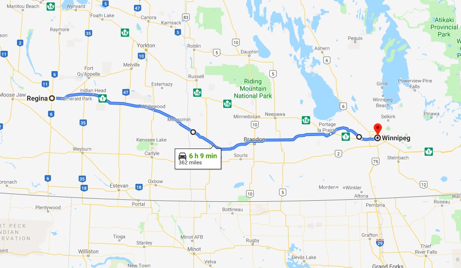
Day’s distance / Total distance – 362 miles / 1,580 miles
Another beautiful day with temperatures ranging from 55 to 85. High clouds at times but mostly sunny. Wind at my back all day.
I could not order a more perfect day.
My GPS routed me out of Regina via the Albert Memorial Bridge. The bridge is rumored to be the longest bridge over the shortest span of water in the world.
The bridge is the pride of residents of Regina. I met two of those proud residents this morning -a father and son who live next to it. They told me about the record it holds which I mentioned above. Too cool.
After riding for over an hour, I pulled off onto one of the frequent ranch roads to eat a banana I grabbed at breakfast.
I promised more creative shot that still captured a sense of the geography.
Soon I was crossing into Manitoba – another first!
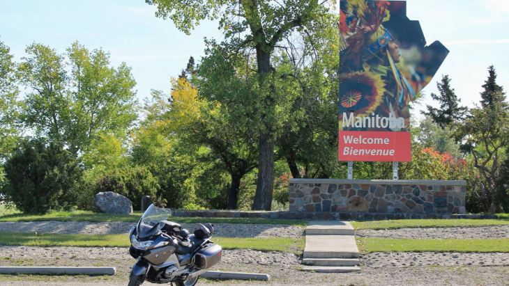
Well into Manitoba, and during my second fuel stop, I met Gordon. We chatted for a while. He told me of his ride in South America and I spoke of some of my rides.

He suggested I follow him into Winnipeg and that we use Hwy 26 to get there, describing it as a rural and sometimes twisty alternative to the Trans-Canada Hwy.
Off we went!
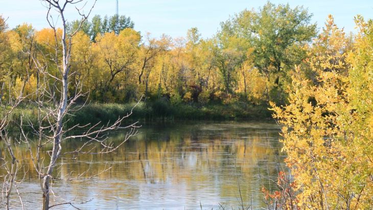
The road surface was pretty rough, with a lot of patches and more than a couple significant frost heaves. However, that didn’t keep us or other bikers (and bicyclists) from using it.

Fall colors are starting to appear in this part of the country.


I chose to stay at Fort Garry, a historic hotel in the heart of Winnipeg.

After a swim and sauna at the hotel, I strolled across the street to The Keg for dinner. Yum!
Tomorrow, Day 6, is my longest day, measured by expected time in the saddle. I’ll reach Thunder Bay on the shore of Lake Superior.
I first visited Lake Superior on Day 7 of my 2016 Northern States Tour at Silver Bay, Minnesota, some 130 miles to the south of Thunder Bay. It will be great to see it again.
Day 6

Day’s distance / Trip distance – 433 miles / 2,013 miles
Temperatures during the day ranged from mid 60s to mid 80s with sunny skies.
The hotel had secure underground parking where the bike spent the night. After breakfast, I brought it out for loading.

It was already warm and quite sunny.
I left the hotel about 8:30. Most of the traffic was coming into the city, so my journey east wasn’t too bad.
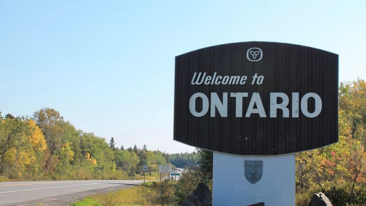
A short time later, I crossed into Ontario.
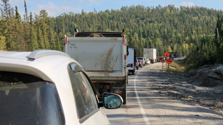
Following Hwy 17 now, I continued east towards Thunder Bay. The road is mostly two-lane concrete with occasional passing lanes. There were many construction zones between Winnipeg and Thunder Bay.
In each construction zone, they appeared mostly to be resurfacing the roadway with asphalt. Typically, only one lane was open and traffic would be allowed in one direction at a time.
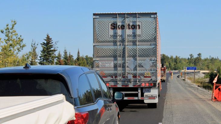
Plan for delays. Although the map indicated the ride should take 7.5 hours, the reality was it took over 10 hours, counting fuel stops and lunch.
Lunch was in Vermillion Bay at the Comfort Table Bakery.

I had a strong cup of French press coffee and a meat pie that was delicious.

In Winnipeg, I had a wedge salad with dinner. Those seem to be a very midwest thing. Meat pies, also midwest and east coast.
The road looked pretty much the same through the day – woods on both sides with small lakes dotting the landscape.

The speed limit along Hwy 17 was 90 kph – roughly 58mph. It made this high mileage day also the longest day in the saddle. In addition, I crossed another time zone.
Cell reception was pretty consistent along today’s route. I was able to update folks back home throughout the day.
It was dark and foggy when I arrived at the hotel. Apparently I just missed a huge downpour.
Tomorrow I take a day mostly off the bike. I’ll stay in Thunder Bay and use the motorcycle only to visit the local falls and see the downtown. The hotel has a gym and pool facilities, so I’ll plan on a good workout, too.
After speaking with a number of people with experience visiting Nova Scotia, and getting weather updates as I get closer, I’m planning on modifying my schedule a bit. Stay tuned for more on that.
Day 7

Day’s distance / trip distance – 55 miles / 2,068 miles
The day started out foggy. I woke up about 7:30 local time and couldn’t see more than about 100 feet. But it quickly burned off and was sunny and warm by 9am.
As today was a day off, after breakfast I went to see the Kakabeka Falls, located about 25 miles west of Thunder Bay.
Part of the Kakabeka Falls Provincial Park, these 40 meter high falls are the second highest in Ontario.

Boardwalks were built on both sides of the falls …

and adjacent to the bridge across the river just upstream.

One of the local residents suggested lunch at The Eddy, a restaurant located right in the village of Kakabeka Falls.

I had a locally sourced burger and fries.

Afterwards, I rode to a small park just above the Marina to get my first picture of Lake Superior.
While rain wasn’t predicted, it sure looked like the overcast was going to build up into an afternoon shower.

While downtown, I stopped at the Groggy Toad coffee house.

That’s a carrot cake muffin and the best latte I’ve had in days.

Returning to the hotel, I took the opportunity to use the gym and pool facilities.
By then, it had started to rain – nothing heavy but nice and steady. The bike would stay parked for the rest of the day.
Around 8pm, I walked across highway 61 to the Neebing Roadhouse for a light dinner and a beer.
I sat at the bar and asked for a draft beer unavailable to me in the US. We settled on a Richard’s Red.

Short rib tacos were an ideal snack. It was a midwest take on tacos – tasty but not at all spicy.
My bartender, Derrick, was a math major completing his undergraduate degree.
Interestingly, when we settled the bill and brought out the card processing machine, it (again) offered to settle in CAD or USD. I shared my experience at the hotel in Kananaskis with the 4% hidden fee.
I get an email immediately after any international transactions, so we were able to verify that this device also added roughly 4% to the USD amount – a hidden fee for the converstion.
Like before when told of the surcharge, the bartender said he didn’t know and said that the staff wasn’t told.
Tomorrow I head east along the north shore of Lake Superior. Back to it!
Day 8

Day’s distance / Total distance – 310 miles / 2,378 miles
Temperatures ranged from the high 50s to the mid 70s today, but most of the day was in 60s. Clouds and some fog were present most of the day, as well, until I approached Wawa, my destination. It seems the temperatures rose and the clouds disappeared as the road moved away from the lake.
I always plan on a ride taking about 25 – 30 percent longer than predicted on the maps. This includes fuel stops, food stops, and chatting with people along the route. Today took even longer because there were many construction zones. It seems there is a nation-wide effort to widen the Trans-Canada highway.
Hwy 17 leaving of Thunder Bay was a four-lane highway with a moderate amount of traffic. Cloud cover made for bad light and I didn’t take any photos until reaching Nipigon, about 70 miles east, where Hwy 11 splits off from Hwy 17 and takes a more northerly route to North Bay.
I chose to stick close to the lake and will pass through North Bay in a few days.

The Nipigon River Bridge was a pretty cool looking cable-stayed bridge built in 2013.

The north shore of Lake Superior is heavily wooded land. The area between Nipigon and Rossport was quite scenic.


I met other bikers when I stopped at the Aguasabon Falls & Gorge and would meet them again as we were all traveling east.

Aguasabon Falls & Gorge

I stopped for fuel and a quick subway sandwich about noon in Terrace Bay before continuing east.
The clouds began to lift and the temperature rose into the 70s.

I rode through White River, Winnie-the-Pooh’s hometown. There was a park exhibit in his honor.

One of the biggest sections of multiple construction zones was east of White River.
I reached Wawa shortly after 5pm. I stopped in the town to grab a bite to eat before heading to my motel, located a few miles further south on Hwy 17.
Tomorrow I will ride through Lake Superior Provincial Park and the east side of the lake to Sault Ste. Marie where I turn east to ride along the north side of Lake Huron to Sudbury, Ontario.
Day 9

Day’s distance / Total distance – 334 miles / 2,712 miles
I woke up at 6:30 local time ready to pack up and hit the road. The bike was packed an hour later. I was thankful that there was no fog, disappointed that it was cloudy, again. It was warm – mid 60s – so there was that, anyway. 🙂
The motel didn’t serve a breakfast so after I had my coffee in the room and packed up the bike, I went into Wawa to grab a breakfast croissant from Tim Horton’s.
Today’s highlight was a ride through Lake Superior Provincial Park. Recall that in my ride planning post, it was Angela Murray’s claim that “[t]he stretch of highway along the shore of Lake Superior from Wawa to Sault St. Marie is known as one of the most scenic rides in Canada and will leave you breathless …”
It was spectacular, indeed. Despite intermittent showers and clouds, it was beautiful.

I entered the park from the north boundary, heading south. I think I saw that best parts of the park first.

Since it was still pretty early, there was little traffic. I felt comfortable pulling off to the side of the road and hopping off the bike to get a photo.

The road was in good condition and the speed limit, if it matters, was 90kph throughout the park.

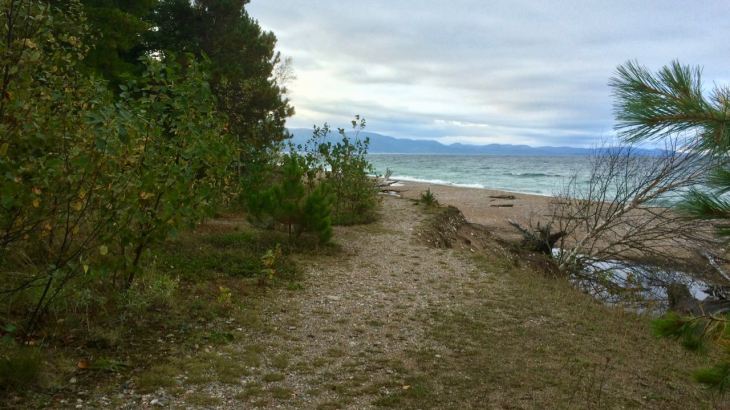
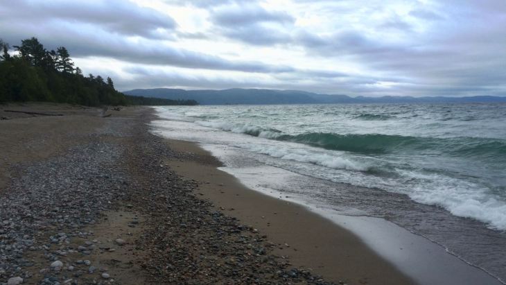
There were several access points to beaches and the water’s edge.

Stopping at the Agawa Bay Visitors Center, near the south end of the park, I wanted to see the exhibit and make sure I didn’t owe a day park fee.

While there, I took the opportunity to walk out to the water’s edge.
After I left the park, I stopped at Scott Coffee Company in Sault Ste. Marie for lunch.

I have been missing my green smoothies, so a quinoa and kale salad was in order. It was yummy. Of course, I had a latte and dessert, too.

The ride along Lake Huron’s north shore was much less scenic. Access was severely limited in comparison and the areas were more built up. The highway was busy with traffic and I didn’t take any photos.
After checking in to my hotel in downtown Sudbury, I worked out and then headed out to The Laughing Buddha for dinner. It was recommended by hotel staff and, just as important, it was within walking distance.
I found it to be an excellent place to have dinner. I had the Beau’s flagship offering, Lug Tread Lagered Ale, named after the tire treads of a small tractor, a true symbol of Eastern Ontario. … Lug Tread is top fermented (like an ale) and then cold aged, or “lagered”, for a lengthy period. This gives it some light ale notes, complemented by a lager-like crispness.
With the beer, I had a most unusual pizza. Garlic butter, salami, bacon, pickles, fresh dill, mozzarella and a dijon aioli.

The staff was great. I recommend checking it out if you find yourself in downtown Sudbury.
If you are in Sudbury, watch for the potholes. The streets here are so bad – so, so bad.
Tomorrow and the next day both exceed 400 miles. Recall that part of this trip was to see how it felt to get to the east coast more quickly. In my Northern States Tour, it took three weeks to reach Maine. I will get to Nova Scotia this time in just twelve days.
Please forgive me if I don’t take a lot of photos. I will do so if I see interesting things, but I’ll be very focused on getting an early start and seeing the miles done.
Day 10

Days distance / Total distance – 411 miles / 3,123 miles
While it was in the high 50s and cloudy this morning in Sudbury, it was sunny and in the high 70s in Montreal this afternoon. I am riding this streak of good weather for as long as I can!
I was up at 6am, having a coffee in my room and was first in line for breakfast at 6:30. By 7:30 I was starting the bike up.
I did stop for gas before heading out of town. It would be another two hours before I would stop again.
As expected, I didn’t take many photos today. There were scenic bits of the route. Farms dotted the landscape just east of Sudbury. But the route was especially gorgeous when the Trans-Canada Highway began to follow alongside the Ottowa River, starting in Mattawa, Ontario.
Traffic was heavy through Ottowa, which I reached about 2pm. There had been two traffic accidents earlier in the day and it appeared that rush hour had already started. I put my feet down, in other words stopped fully on the highway, a few times before getting through the city.
The traffic in Montreal was heavy going out of town. I had it easy going into town and reached my hotel at 4:30. My GPS originally predicted I would reach it at 2:55, so I only lost an hour and thirty-five minutes to fuel stops / food breaks / construction zones over the course of the day.
For the blog today, I thought I would list some of the many things I am grateful for, since I don’t often stop to acknowledge these.
I’m grateful for my best friends back home, Carson and Will, who help to support my trips. While I travel alone, it is not without help from them. Knowing they are available brings me the confidence that I can overcome any hurdle the road throws at me.
I’m grateful for my health. I travel by motorcycle while I have the option to do so and expect to continue as long as I can. Lyam and Jason both help keep me in top shape, making possible these crazy long adventures.
I’m grateful for such a reliable motorcycle and for those who help keep it serviced, especially Jorge, who has supervised most of the maintenance of my bike since I bought it nearly seven years ago. And there’s Chris, whose knowledge and experience with bikes in general and BMWs, specifically, has come in handy many times.
I’m grateful for all those who follow my travels through the blog, sending encouragement all these years. Family members, Charles, April, Al, Christopher, Jed, and Lynda come to mind, but I know there are more.
Finally, I am grateful for the motorcycling community. From a quick wave or a head nod as I pass, to a conversation at a fuel stop, I can say that while I travel solo often, I don’t often feel I’m traveling alone.

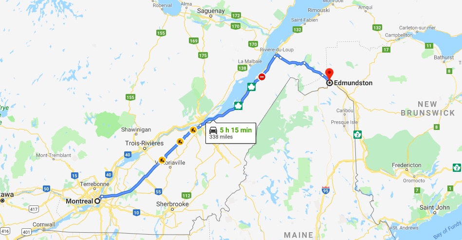
Tomorrow, I ride north to Edmundston, New Brunswick. Another Canadian province <yay>, and another time zone change <ugh>.
The good news is it is only about a 350 mile ride and not more than 400 as I originally thought. The weather should be sunny the entire day.
Stay tuned!
Day 11
Day’s distance / Total distance – 360 miles / 3,483 miles
Another beautiful day from a weather perspective. Sunny with temperatures mostly in the 60s and 70s.
I left Montreal about 8:30 after having breakfast at the hotel and having a wonderful conversation about travel with Connie from Colorado.
Almost immediately I made a wrong turn and took about 10 minutes to backtrack to the hotel to start again. Oops 😦
The route off the Isle of Montreal and out of town was actually pretty packed. I will give the Canadians credit though, they can travel at speed on a packed highway without causing chaos.
I stayed pretty focused and it was about two hours before I stopped to get a latte and muffin from a pretty deluxe McDonalds.

This McDonalds had croissants, muffins and other assorted pastries, lattes, cappuccinos, and more – kind of like the combination of Starbucks and traditional McDonalds.
I saw a lot of bikers out today. They were mostly non-communicative on the road, meaning no waves or nods. And when they were parked, they were not open to chatting, or at least in English with me. That part was a bit of a bummer.
The Trans-Canada Highway diverts around Quebec so I didn’t see any of that ages-old city today. You can’t fit everything into a single ride.
After passing Quebec city, I kept seeing the St. Lawrence River in the distance. I decided to detour off the highway at a nearly random exit to get down to the waterfront for a photo or two. I say nearly random because the turnoff displayed a boat launch, so I figure there was a marina or beach.
Sure enough!

People were out on this beautiful day. The couple on the right (in the striped shirts) asked me some questions about my trip. Only she spoke English and I speak no French, but they were impressed that I rode from WA.

Back on the road, I eventually crossed into New Brunswick, or Nouveau Brunswick if you are French.

Another province off the bucket list!
I arrived in Edmundston, NB about 5:30pm. It was another long day, made longer by the fact that I had to go back out on the bike for dinner. I much prefer to walk to dinner or, like last night, have dinner at the hotel if the restaurant is a good one.
Tomorrow is a full day if I get everything I plan to do accomplished. I will leave here at 7am, drive to Truro, Nova Scotia via a detour to Prince Edward Island over the Confederation Bridge, a 12.5km bridge across Abegweit Passage of the Northumberland Strait. It links Prince Edward Island with mainland New Brunswick, Canada.
This should be a fun day. Weather is predicted to be sunny and warm, though it may be a bit breezy. Total mileage will be in excess of 450 miles, making it my longest day of my ride across Canada. This is the last day of nice weather, so I’m trying to accomplish as much as possible before reaching the Cabot Trail on the next day when the showers begin.
Day 12

Day’s distance / Total distance – 451 miles / 3,934 miles
The day’s temperatures ranged from 38 to 76 and was sunny with the exception of some fog in the first hour of the ride. Another beautiful day!
One of the benefits of traveling this time of year is to see the leaves change color. This morning, as I was waiting for the sun to rise and the temperatures to warm, I had to remind myself they change color because of the short days and cold nights and to not be a baby about the cold temperatures.
Here’s what I saw when I first pulled out onto the highway this morning.

Honestly, within the first two hours, the temperatures were in the mid 50s and climbed into the high 60s before noon.

The Trans-Canada Highway in this part of Canada mostly looks like any interstate in the US – perhaps a bit more scenic.
I left the hotel at 7:30, as soon as I felt it was light enough to see animals that might still be out on the roadway. My first destination was the Confederation Bridge, the link between Prince Edward Island and mainland New Brunswick, Canada.
I stayed focused and made the first 250 miles before noon. At a fuel stop, I met a couple of Americans. They were from Pennsylvania and Maine.

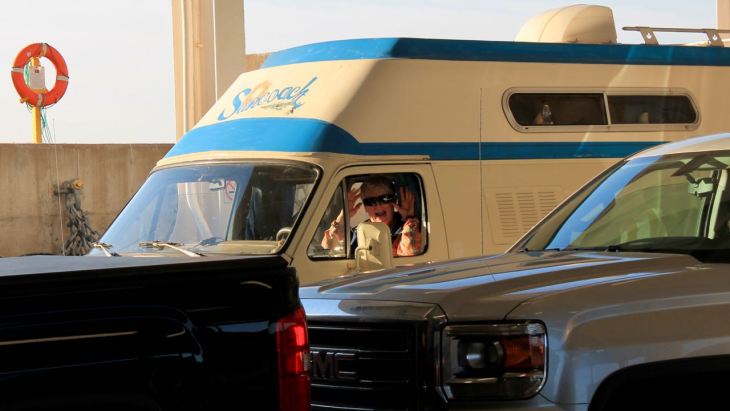
It was at this stop that I decided to take the ferry off of Prince Edward Island instead of backtracking over the bridge, my backup plan if I didn’t have time to cross the island and take the ferry.
My friend Will made reservations for me from Seattle while I took off leaving my Amercian friends to eat their sandwiches. I had another 90 miles or so to reach the bridge and the timetable to the ferry was tight.
I arrived at the bridge just before 2pm and grabbed a photo before crossing it.

The Confederation Bridge is an 8-mile box-girder bridge (concrete piers support rectangular steel and concrete girders holding the roadway).
Travelers pay a toll to get off the island, whether you get to the island by bridge or ferry. I would take the bridge on and the ferry off today.
It was a fun trip over the bridge and seemed to take about 15 minutes to cross.
I guess I was spoiled by the drama of my 2016 crossing of the Chesapeake Bay Bridge on Day 24 of my Northern States Tour. It was windy and rainy on that day the the Bay Bridge is both bridge and tunnel.
Anyway, my first stop was the Lobster Shop for my first lobster roll since that 2016 trip.

Yum.

After the sandwich, I continued across the island towards the Wood Islands ferry terminal. According to the GPS, I had about 20 minutes of “extra time” to stop and take pictures.


The island seemed a mix of rural and city and I was soon caught up in the traffic, especially as I went through Charlottetown in the center of the island. I panicked as my “extra time” quickly disappeared. I switch focus to getting to the ferry terminal on time.
That was made harder by both multiple road construction sites and by the 22nd annual 70-mile yard sale event that was going on this weekend. Yeah, I couldn’t make this up – there were yard sales everywhere. People were parked along my route throughout the town!
I did make it, only 3 minutes after I was suppose to arrive and was priority boarded towards the front of the boat.

As I was strapping down the bike, a woman walked up to me and asked me a question about the ferry. At first I said this was my first time and didn’t know the answer. I then realized that because I wear a yellow vest and black outfit, she thought I worked on the ferry.
We laughed over that, and ended up chatting the whole two hours. Deane travels in her van with her dog and we shared travel stories.
I couldn’t resist taking a few lighthouse photos while on the ferry. The first was the Wood Islands Lighthouse.

The next was the Caribou Lighthouse in Pictou (pronouced “pic two”).

It was a long day – lasting almost twelve hours. I backtracked from the ferry to Truro, NS as I had already made a reservation here earlier on the trip.
Tomorrow I head to back east to Cape Breton Island and the Cabot Trail for my penultimate day in Canada.
Day 13

Day’s distance / Total distance – 287 miles / 4,421 miles
The weather varied throughout the day. The temperature started and finished in the 60s and was as warm as 80. Clouds came and went and then returned with some rain showers for my last hour on the road. Winds were gusty and stronger on the eastern side of Cape Breton Island.
Today’s goal was to ride the Cabot Trail, located on the north half of the island. There was no great bridge like there was to Prince Edward Island yesterday, just a simple causeway and voila!

A few miles further north and you’re on the Cabot Trail.

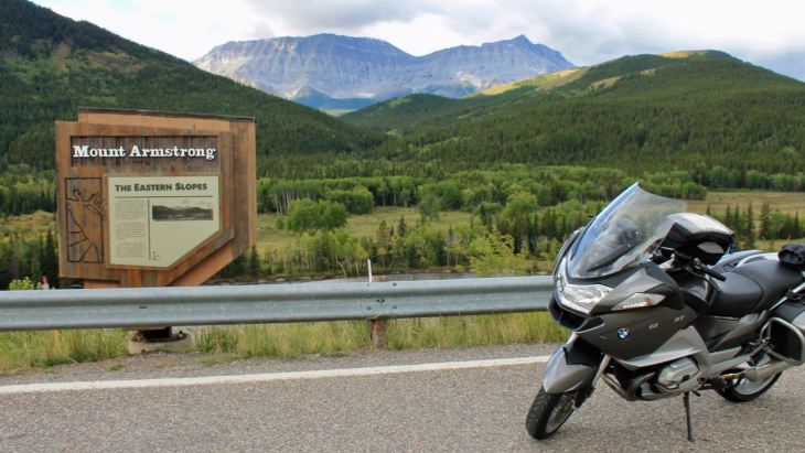
This was the fourth scenic area on my Trans-Canada tour that included the Bow Valley Parkway near Lake Louise on Day 2,

Highwood Pass south of Kananaskis on Day 3,

and Lake Superior Provincial Park on Day 9.
The Cabot Trail was a great goal – scenic, sometimes twisty and often a challenge to ride, much more challenging than any of the three other scenic places.
Here are some pictures of the scenery around the island as well as some of the roads themselves.
The Kidston Island lighthouse seen from Baddock.

The Cabot Trail near the Lobster Galley …

and near St. Ann’s Provincial Park.

The shore north of St. Ann’s Provincial Park.

South of Ingonish

South of Wreck Cove

Park entrance in Ingonish, where a day pass for the park was purchased.

One of the two big construction zones on the island. This was the one on the eastern side, between Pleasant Bay and Chéticamp.

North of Chéticamp.

I talked with many folks today, but Mary is someone I expect to keep in touch with in the future. We met twice on the trail over the span of several hours, once on the western side of the island and again at the Rusty Bucket restaurant in Pleasant Bay where I stopped to have a bucket of mussels for an early dinner.
My last 30 miles, from Pleasant Bay to Chéticamp was in the rain. I had a great streak of dry and warm weather, up to and including this afternoon.
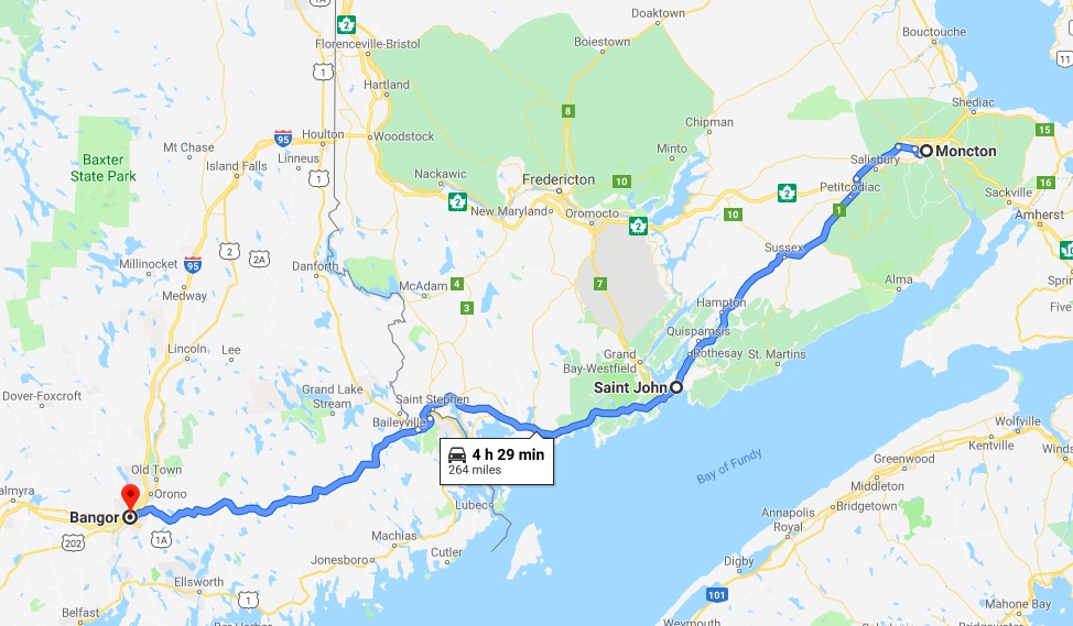
Today was my “turnaround” day. I head south tomorrow – back to Moncton, New Brunswick – for my last night in Canada before heading to Maine and, eventually, back to Seattle.
It feels like this day marked the end of my ride across Canada <woo hoo!> and tomorrow begins my ride home from Canada. Stay tuned.
Day 14

Day’s distance / Total distance – 305 miles / 4,526 miles
Passing showers dominated the day’s weather. Temperatures started in the mid 50s and reached the mid 60s. It was ‘breezy’ on the island, and the clouds moved quickly across the terrain. Fog was a brief, minor issue over Cobequid Pass approaching Moncton.
Through all of it, my gear kept me dry with the exception of my gloves, which are not waterproof but are well protected from the wind and most of the rain behind the fairing. Eventually they get wet but that’s when I turn on the heated grips.
The first couple of stops I planned were still on the island. Since the motel only supplied coffee and no breakfast, the Boulangerie Bakery, just down the street was first. I grabbed a cinnamon roll, and bacon / cheddar scone for second breakfast, and a coffee.

Next was an attraction just south of Inverness, the Glenora Distillery.
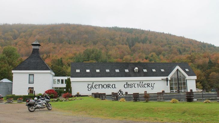
I missed the 10am tour by minutes and didn’t want to wait for the next one, so I picked up a mini-bottle of 10-year old whiskey and continued on my way.
The island has many small villages. I struggle with capturing the sense of these towns as they are typically pretty spread out.

The Celtic roots of the island are celebrated in their music scene and, where in Montreal you’d find signs in French, here you see Canadian Gaelic or Cape Breton Gaelic.

For example, at the post office in the town of Mabou (shown above), Tigh Litrichean is translated as “house of letters.”
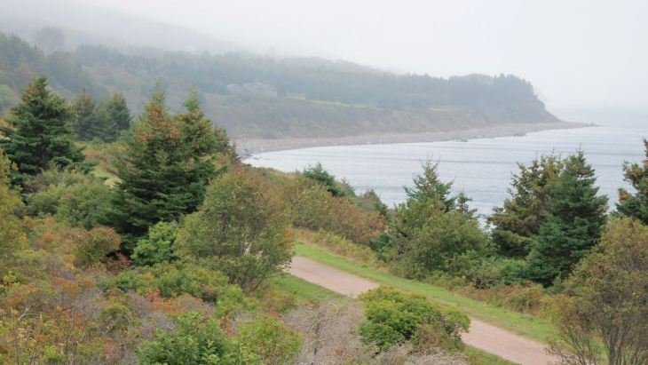
Below is the south western coastline of the island just before crossing the causeway back to mainland Nova Scotia.
The rest of the ride to Moncton, which took about three hours, was punctuated by heavy showers and fast moving traffic.
I decided to stay in Moncton and extra day and I will use the time to plan out the next week or so of my trip and wait out tomorrow’s predicted rain.
For tomorrow’s blog post, I’ll post the plans I come up with.
Day 15
Today was a day off the bike to plan out the first half of my ride back to Seattle.
Tomorrow I return to the US and head for Bangor. In the days that follow, I will ride through New Hampshire, Vermont, New York, Pennsylvania, Maryland, West Virginia and into Ohio.
On Day 23, I have an appointment to get the motorcycle serviced in Columbus, Ohio.
I will use these next days to wonder around the northeast hoping to see some color in the trees and revisit a few of the places I saw in 2016 on my Northern States Tour.
Planning for my ride from Columbus to Seattle will take place during the day my motorcycle is getting serviced, when I know more about the weather I’ll be facing.
For this section, the weather is looking good with the exception of some afternoon thunderstorms – a regular occurrence on the East Coast.
I’ve made motel reservations along the way and in Columbus. This helps me be less anxious, especially since some of the places I’ll visit are likely to be visited by other tourists looking for a weekend getaway to see the leaves change color.
In fact, during my planning today, I had to adjust some daily start/end points because there was no lodging available.
Follow along and enjoy the ride!
Day 16
Day’s distance / Total trip distance – 266 miles / 4,792 miles
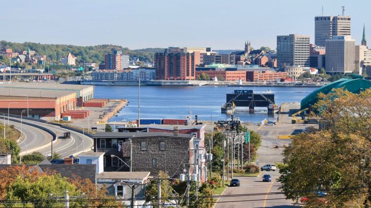
Temperatures today ranged from 48 to the mid 70s. It was cloudy in Moncton but cleared up, and warmed up, by the time I reached Saint John.
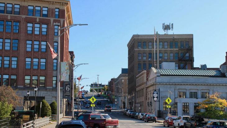
I stopped at a Saint John’s Starbucks and after wondered through Saint John to see if I could stumble into any good photo ops.
I found myself down by the docks in an older section of downtown.


Then I wondered over to a neighborhood south of downtown and walked to the top of King Square park …

to get this shot of the downtown from across the water.
My next stop was the border crossing, which was pretty quick once I made it to the booth (10 minutes total wait time).

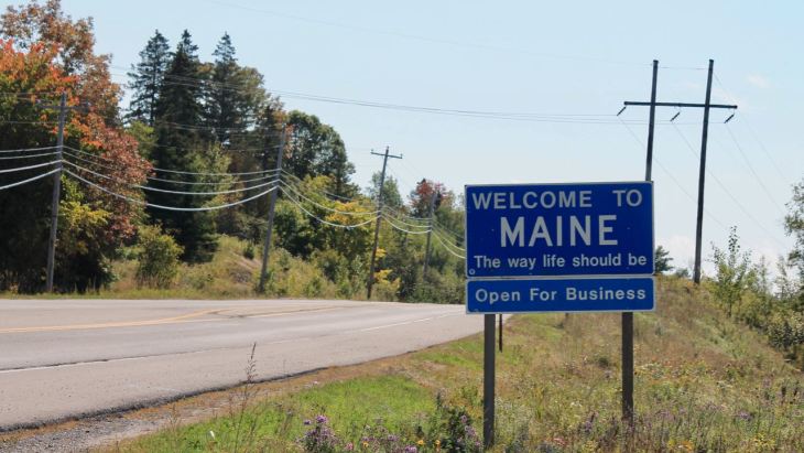
I crossed into Maine about noon (local time), having gained an hour back with the time zone change.
As a baseline for color in Maine, I stopped along Hwy 9 about halfway to Bangor at Machias River to get this shot.

The maple trees are yellow to red and contributing the vast majority of color to the forest at this point.
Dinner tonight was at the restaurant next to the motel. I had a quinoa salad and a few beers while I met several locals and one other traveler and enjoyed the time.
It’s really true that traveling solo provides me with the most opportunity to meet and talk with others.
Tomorrow I’ll travel through more of Maine and end up near Berlin, New Hampshire. I’m not sure how much color I’ll see in the trees but have chosen one or two good motorcycle roads to entertain me and use the sides of my tires instead of just the center. 🙂
Day 17

Day’s distance / Total trip distance – 243 miles / 5,035 miles
Today was sunny all day with temperatures ranging from the mid 50s to mid to high 60s. A beautiful day for motorcycling.
I started with a short ride to the historical downtown core for a latte. The coffee in the motel pretty much sucked today, so I could not leave town without one.
While I was sipping it, I stood outside and tried to capture a photo that provides a sense of the downtown. Here’s the one I thought was best – think of that as a relative term – lol.
With latte in belly, I took off heading west on Hwy 2.
As I traveled through one small town after another, I came across a solar plant in Pittsfield. Turns out to be a 10 MW AC solar project, Maine’s largest.
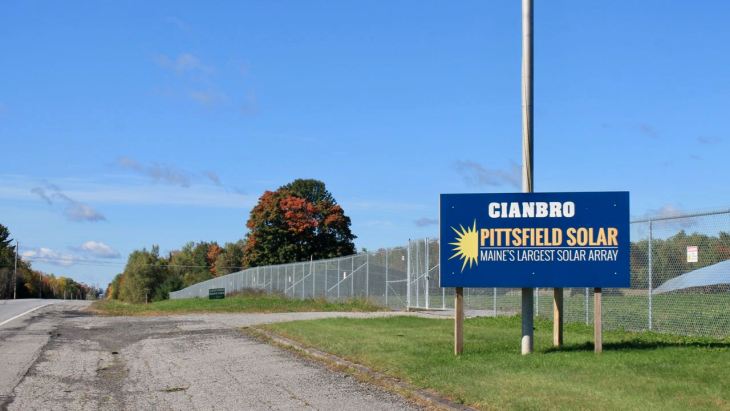
This is enough equivalent power to support about 6,500 households. The 41,000 panels cover 53 acres.

I stopped at a few spots throughout the day to try to capture more of the scenery that I saw from the road.
This was a local park I passed. Ironically, there was signage prohibiting swimming – due to the “risk of drowning.” Seriously?

I turned north onto Hwy 17 when I reached Mexico, Maine, “Gateway to the White Mountains.” Also known as Rangeley Lakes National Scenic Highway, it’s a popular motorcycle road.
The surface of the road itself was a bit rough but it was twisty and fun, with some whoops and a 50 mph limit in most areas.

Then the road suddenly opens up to a vista that was stunning.

My route today took me around all of the lakes in the photo above.

There were a lot of vacation homes along one of the many lakes in the area. Reminded me of the movie On Golden Pond. <Norman, the loons!>

My route took me into New Hampshire …

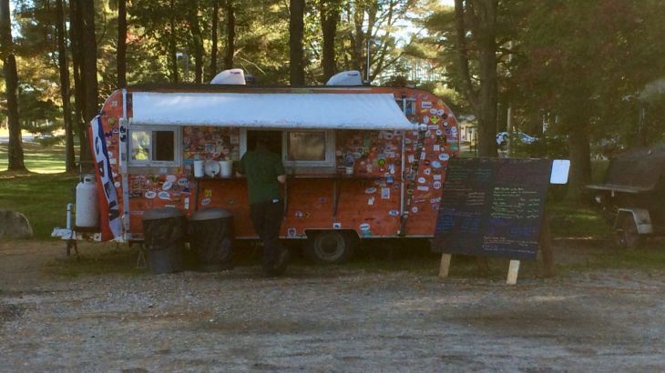
then returned me to Maine. I stopped in the town of Bethel for fuel and saw a food “truck” across the street – the Smokin’ Good BBQ.
Since I was hungry I ordered some baked beans and cornbread for an early dinner appetizer (it was about 3:30pm).
I shared a table with two local bikers.
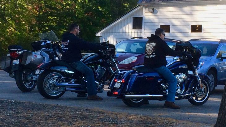
They both seemed blown away by the distances I’ve traveled. Neither had ever ridden beyond the “next state over”, which starts 20 miles away 🙂
After eating, I rode to the motel, just over the border and unpacked. Since I had to head into town for food, I left immediately and ended up having more BBQ at the Road Hawg BBQ in Gorham.
Tomorrow I head into the White Mountain National Forest on my way to Montpelier, VT and then to Lake George, NY. Afternoon thunderstorms are expected. We’ll see if I can reach my destination prior to their arrival.
Day 18
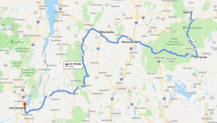
Day’s distance / Total distance – 264 miles / 5,299 miles
Temperatures started in the mid 50s but warmed quickly. I took off my jacket liner at 10:20 and it hit 81 in the early afternoon before it dropped to 68 and started raining. Afternoon rain showers cooled things off, temporarily, before I saw temps in the upper 70s again.
I rolled out of the motel just after 7:30 and headed to the White Mountain Cafe in Gorham, about six miles away, to get a latte and breakfast sandwich.
There was a bit of fog in the hills, but otherwise beautiful.

Breakfast was good and I was grateful for the latte.

Afterwards, I headed south on Hwy 16 towards Conway. I quickly came to the Mount Washington Auto Road. I rode past here on my Northern States Tour three years ago.
At that time, I stopped and looked into the details. There was an entrance fee of $16 and would take up to two hours (with photo stops) to reach the summit and return. I skipped it back then.
In planning for this trip, I told Carson that if I had the chance again, I think I would ride to the top. Well, I had the chance today and, again, skipped it.
I just can’t get myself to wait in line to ride up this 6,288 ft high mountain road. Besides the fact that today was already a full day, it seems the antithesis of the type of motorcycling I enjoy to be queued up to follow others up and down a mountain.
I continued into Conway and remembered that I stayed in this town back in 2016. I remembered the motel when I road past it, and I remembered stopping at the Starbucks down the street.
That particular Starbucks was giving me my order for free because they thought I was a police officer. The bright yellow vest and motorcycle gear gave them that impression. I smiled and paid for my order after telling them I wasn’t a cop.
This time I stopped only at an Auto-Zone store to pick up some spare oil for the motorcycle before continuing to the first potentially scenic ride of the day.
Hwy 112 North was next. It took me through the White Mountain National Forest.

I’m still a week or two early in the fall for peak color in the trees, even at the Kancamagus Pass.

I wondered why there was so much traffic until I remembered it was Saturday. All the pullouts were packed with cars and it was a struggle to keep my distance from other cars while riding this section of 112.
At this stop, there was a wedding party taking pictures (just out of frame to the left). 🙂 I still managed to get a photo that makes it appear I was there alone, haha.


The next section of Hwy 112, to the west of the I-93 was much less crowded and every bit as scenic.

Heading towards Woodsville, I came across the Swiftwater Way Station, a convenience store I stopped in during my 2016 ride to wait out a rain storm. I had to stop and get another slice of pizza and say hello.
The folks at this mom and pop business didn’t remember me but I remembered her. I told them of my previous visit to the store and my rides from Seattle. The visit stirred a feeling of familiarity with the people and places of this area, just like seeing Conway again.
In Woodsville, I would cross the Connecticut River into Vermont.

I stopped outside of Montpelier for fuel. I put on rain gear as the roads were wet and dark clouds showed up for an afternoon rain. The temperature dropped back into the high 60s and the wind picked up.
I didn’t stop in Montpelier this time, as I was running a bit behind. I would need to get to New York still.
Riding south on Hwy 100 was my next scenic section. The highway runs north and south in parallel to I-95 but, of course, is a better motorcycle road. It passes through many small towns, each with their own character steeped in history.
This section of highway is referred to as the Mad River Scenic Byway and follows the Mad River. In Waitsfield, there is a covered bridge crossing the river.

I chose to change and take this route at the suggestion of the owners of the Way Station mentioned earlier. It was the way to go!

I had ridden part of this highway in the other direction in 2016. It was the best part of the day this time, with a short section of scenic twisties that I turned around and rode again. 🙂
My ride into Lake George along Hwy 4 was uninspiring in comparison. It was a sometimes-freeway that took folks through many built-up areas.
As I approached my motel in Lake George, I could see that all the other motels had closed their outdoor pools. But I was super-stoked to find the pool and jacuzzi and my motel was still open and still heated!
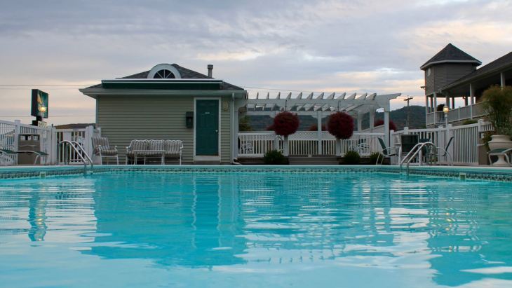
After swimming and using the jacuzzi, I walked to the Adirondack Bar and Grill, a local favorite just down the street.
I chatted during dinner with two folks from the motel. They both ride but were driving this trip. Fred and Vicky were a lot of fun and we swapped stories for almost two hours.
I tried a local craft beer and finished dinner, a steak salad, with a shot of Cloudsplitter, a New York distilled whiskey.
A great evening. A great day of riding.
Day 19
Day’s distance / Total distance – 278 miles / 5,577 miles
Temperatures today ranged from mid 50s to mid 60s. It was overcast in spots but clear skies mostly.
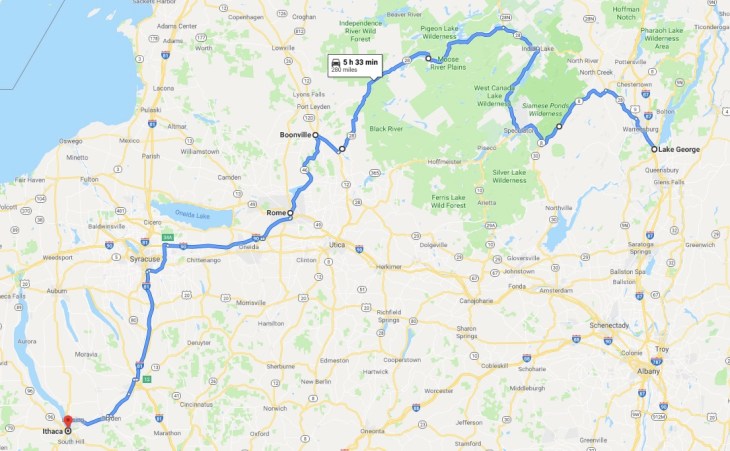
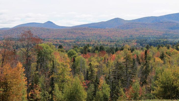
Today’s ride took me through the Adirondack Mountains situated northwest of Lake George.
The colors were still muted, relative to their peak, which is probably still a week or two off.

That’s not entirely a bad thing for a motorcyclists. Wet leaves on the road can be a slippery proposition. Everywhere I’ve been to date have had no leaves on the road.

I stopped in the town of Speculator for a latte and scone.

Hwy 30 between Speculator and Indian Lake kind of sucked. There was a lot of plow damage, the type that plows would make pushing around winter snows.
This is a photo of Ruby Mountain (left) and Slide Mountain (right of center) taken from a park near Indian Lake.
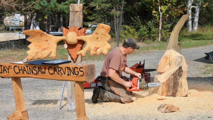
In the town of Indian Lake, a wood artist, apparently named Jay, was carving up a log with his chainsaw.
Indian Lake was pretty crowded with weekend tourists. The crowds cleared up a bit as I rode southwest on Hwy 28.
It was then that the road surface improved and I thought I’d just focus on riding.
With some irony, shortly after deciding to focus on just riding, traffic got heavy (again) and I had to pull over to give the slow moving cars ahead a chance to get way ahead.
It was then that I grabbed a photo of life at Seventh Lake.

I stopped for lunch in Old Forge, giving up on having any more of Hwy 28 to myself.
I grabbed a pulled pork sandwich at the BBQ Pig Out in Old Forge. It came with baked beans, sweet potato fries and a drink.

After lunch, I joined the many, many others traveling south of Hwy 28. It wasn’t until I diverted to Boonville to take Hwy 46 south into Rome that things again became more scenic and, road-wise, and more interesting.

Hwy 46 was the roughest road surface of the day. Still, I wasn’t following a line of cars like back in Old Forge.
After Rome, it was fast-moving highways, interstates, and freeways to my motel in Ithaca, NY.
Tomorrow I head into Pennsylvania, revisited some places from my past. Stay tuned!
Day 20

Day’s distance / Total distance – 297 miles / 5,874
Today’s weather was not so pleasant. Temperatures ranged from low 50s to mid 60s. It rained heavily at times, more lightly at other times. The roads were wet most of the day, with the exception of the last few hours. And, if that wasn’t enough, there was heavy fog in the early afternoon and the last five miles of the ride.
Because of the weather, I didn’t take many photos. But there were a few photos I had to get, even if it meant getting camera lenses wet.
The first third of the ride from Ithaca, NY to Galeton, PA was along larger highways and I-95.

I crossed into Pennsylvania while on I-95 and traveling through heavy rain.
My gear kept me dry with the exception of just around my collar and shoulder where rain would sneak in from the side of my helmet. Oh, and my gloves got wet, but the heated grips kept my hands from getting cold.
I did stop at a bakery in Galeton for some coffee and to take a needed break.
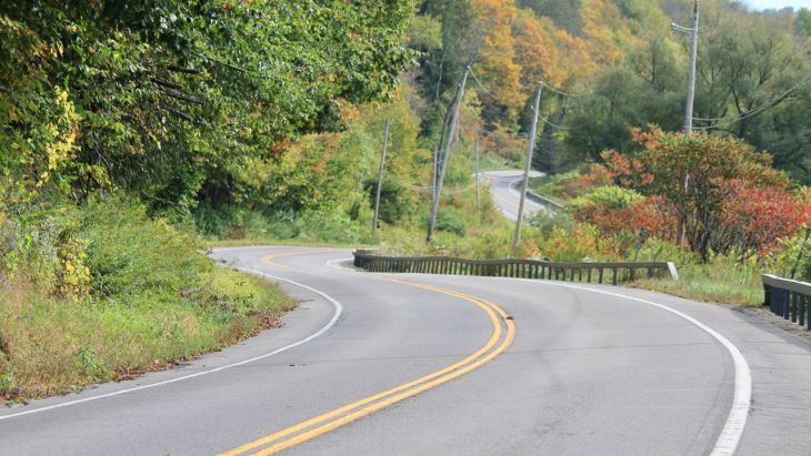
The road I was looking forward to riding, state route (SR) 144 started in Galeton. I learned about SR 144 on motorcycleroads.com, a very useful site. The rider who posted their route along it described it this way, “… a flawless piece of twisting tarmac that ascends and descends the mountains in a series of tight sweepers and fun switchbacks while you are sheltered by mountains on all sides. No stop signs, no intersections…..just ride.”
So the second part of today’s ride focused on SR 144.
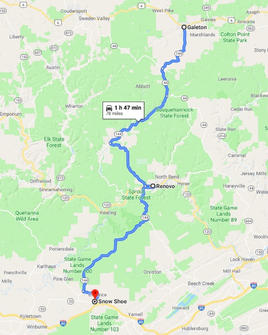
The part of the ride is broken up by the town of Renovo and the West Branch Susquehanna River, hence the funny jog in the road there.
The description quoted above described only a 15 mile section of SR 144. Some other roads merged with the highway, but overall, then entire 78 miles was bliss.
The only downside was a lack of shoulders along most of the route, especially in the northern half. In that regard, it reminded me of the Twisted Sisters, highways in Texas’ Hill Country that I rode on my 2015 Southern States Tour.
Taking photos of a road with no shoulders is difficult. In the past I’ve used the GoPro, but I didn’t bring it this time. I made due by pulling over as far as possible and putting the hazard lights on. Then I hopped off the bike and quickly got the shot.
I did this only twice today, and only after noting the very light traffic (one vehicle came by every ten minutes or so) and low speed limits (45mph and 35mph).
This was my favorite stretch of the top half of SR 144, but all of it was very zen-like.

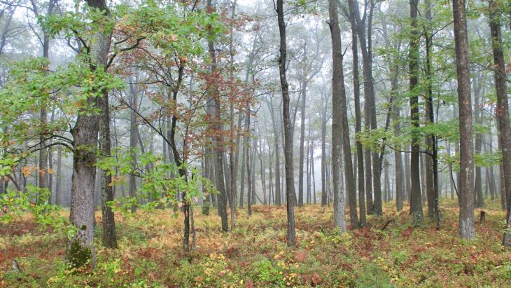
Fog, heavy at times, was waiting for me on the second half, or southern half, of the route. But sometimes fog can make a good backdrop for a fall photo of the woods.
The southern half of the route was labeled as Pennsylvania Wilds Elk Scenic Drive.

The above photo took some effort to get. Most of the signs were shot full of bullet holes. 🙂 This one must have been recently installed – lol.
The last part of the design of today’s ride was a trip down memory lane. I rode through Huntingdon, Pennsylvania, where I lived during my last two years of high school and first year of college.
This was the first time I visited the high school in 40+ years.

And I took the opportunity to drive past the house I lived in back then.
Though it had been heavily modified and was used exclusively as offices now, it was still standing.

That was trippy to see and to see how it changed.
The Dairy Queen was still operating at the top of the hill about half a mile away. Some things never change.
The last section of today’s ride, from Huntingdon to Breezewood was uneventful. Fog was blanketing Breezewood, though, making the last five miles a bit stressful.
As it stands, I have two days remaining to get to Columbus. If I took the shortest route there, using the interstates, it would take about four and a half hours. So I’m going to take two days, a bunch of scenic backroads, and use 460 miles to get there “the long way.”
Stay tuned!
Day 21

Day’s distance / Total distance – 226 miles / 6,100 miles
Temperatures were quite a bit warmer today, ranging from 68 to the low 90s. It was foggy in places for the first few hours but otherwise sunny.
I first headed south on I-70 towards Hancock, Maryland. This part of the ride took only about 30 minutes. Then just over the border, I turned west on I-64 and took that into West Virginia.
Fairmont, West Virginia was the beginning of my ride north on Hwy 250, the “motorcycle road” for today. Before starting up that road, I took a short break at Palatine Park.

The park is located across the Monongahela River from the downtown core of Fairmont.

I would cross over the Adams Street Bridge and ride through a section of downtown before …

topping off my fuel and buying some water to fill my now empty Camelbak. I used the leftover water to dowse my shirt. It helps to stay cool in hot weather.
There wasn’t much fall color in this area, but I found some twists in the road.
Hwy 250 has some good sections and some of the pavement is rough, likely snow plow damage. Most of the road is narrow with no shoulders.
On Day 27 of my Northern States Tour, I rode Hwy 10, not too far from here. Some of my critical comments apply here, as well.
“[T]here were homes and businesses along a vast majority of the ride. This means lots of hidden driveways as well as cars and homes along the side of the road. Also, there were few turnouts and much of the roadway lacked shoulders, making sections a zero-tolerance-for-mistakes type of roadway.”
https://steelhorsejourneys.wordpress.com/completed-rides/2016-northern-states-tour/
Cameron was one of the larger towns along the route. Parts of the town looked pretty rundown.


However, the high school looked great, which left me feeling encouraged.

It’s likely that I was still thinking about my visit to Huntingdon yesterday, where the town was looking pretty depressed but the high school seemed to be holding up well. But Huntingdon always seemed to struggle, being located in an economically depressed area.
A haze in the air kept vista photos to a minimum, but here’s an example of what I saw when I took the opportunity to look up from the road – lol.

There just wasn’t fall color in the amounts I saw earlier in the trip.
Wheeling, West Virginia was my destination for the night. I was only about six minutes from my hotel when traffic came to a halt. Everyone was waiting until one person turned around on the on-ramp.
It was a move I’d never seen before. 🙂
Soon enough everyone was turning around, including me. It ended up taking another hour to reach the hotel just a few miles away as everyone else was taking the same detour.
It was a difficult day, mostly because of the traffic. But my accommodations were not as expected, either, and the check-in process took some time. I’ll save lodging comments for the reflection at the end of the trip.
Tomorrow I land in Columbus and will stay for two nights while the bike gets serviced. It’s going to be 90 in Columbus – another hot day. That won’t keep me from exploring a few back roads on my way!
Day 22

Day’s distance / Total distance – 200 miles / 6,300 miles
Temperatures ranged from low 70s to low 90s. The skies were sunny but there was a haze in the air much of the day.
The route I chose to ride today included Hwy 26, between Woodsfield and Marietta.

I read about this road on motorcycleroads.com. Many of the reviews suggested the road was scenic and in good shape.
I found the ride to Hwy 26 pleasant enough and stopped along Hwy 78 to take a few photos. The road loosely follows Sunfish Creek.

Again, there wasn’t a lot of fall color in this region at this time. It’s scenic in any case.

Hwy 78 had a good surface and some nice sweepers. Nothing technical.
Soon I reached Woodsfield.


I was distracted taking photos and didn’t notice for another couple of miles that I was suppose to turn at that intersection. 🙂
It wasn’t long before I was on the start of the best section of Hwy 26, just outside of the town limits.

This approximately 40-mile long section was totally worth riding. The road surface was in excellent condition. There were no shoulders along most of the route, so opportunities to take photos were limited.
There are a few covered bridges along the route. Watch for them!

This is the Hills Covered Bridge.
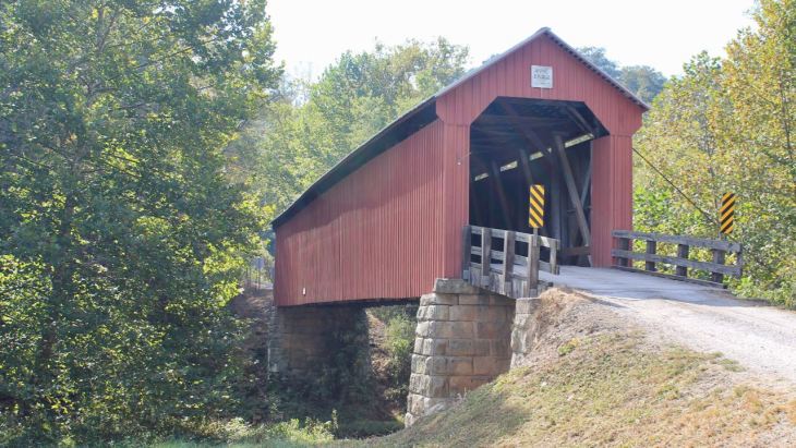
The road to the Hills Covered Bridge was very short but not paved, so I walked to the bridge.

Parts of Hwy 26 were challenging. Lots of blind curves, elevation changes, some changing radius curves and a bit of gravel on the road, especially near driveways.
It was great fun!
Hwy 550 was next. Like Hwy 78, it had nice pavement, some good sweepers and not challenging. It was nice to have it to unwind a bit from Hwy 26.
I dropped the bike off at Motohio BMW for service after getting checked into the motel next door.

This will be a level II service and they will work on the bike tomorrow. I’ll use the day off to plan the final leg of my journey.
Day 23
Today was a day off the bike.
While the motorcycle was getting serviced at Motohio, I spent the day planning the final leg of my journey.
Readers might recall that one of the designs of this trip was to travel farther faster than in the past. In planning the first leg of the trip, across Canada, I referred to it as an “aggressive (high-mileage) schedule.”
The ride home from Columbus will test me in a new way.
Instead of rarely using interstate highways, for this leg of my journey I will exclusively use the interstate system to get home in just seven days.

While this is not Iron Butt territory (1,000 miles in less than 24 hours), I will average 377 miles per day, covering roughly 2,650 miles in the next week.
I’ll be averaging roughly seven hours a day actually riding. Adding breaks and fuel stops, I’ll expect to be in the saddle about nine hours each day. That’s no longer than I’ve been doing and leaves plenty to time to eat, exercise or swim, and rest.
Temperatures should not be too cold until I reach the Rockies and the Cascades where I’ll have to stay bundled up. It may rain on me on Saturday, as I ride into Kansas, but is predicted to be clear otherwise. I expect it to be windy through the Midwest.
As I’ll be focused on getting those miles done each day, unless I detour to do an interesting road, I’ll probably not be taking too many photos.
And, expect daily blog posts to be shorter. I’m not sure what I’ll write about after spending all day on the interstate 🙂
I’ll try to get creative during this leg, and I may surprise even myself.
One final note – I’ve made all my reservations changeable so if I hate this plan, I can make changes.
Stay tuned!
Day 24

Day’s distance / Trip distance – 433 miles / 6,733 miles
It was a sunny day. Temperatures ranged from 50 to the mid 70s. Very pleasant.
I packed the bike up while it was still getting light out, about 7:15 …
but didn’t leave until it was light some 30 minutes later.
I could tell right away the heatwave Columbus had been experiencing was over. Still, it was only 50 or so, not too bad for someone from Seattle.
I pulled out of the motel and was waiting at the first light, deciding whether to get fuel now or wait. Then I noticed the car in front of me, also turning to get on the freeway, was watching Netflix on her cell phone. That clinched it – I wasn’t going to stay anywhere near them. So I pulled into the station across the street and filled up.
Come on, people. Driving is serious business. More on this later.
My first stop was a little over 100 miles later, for second breakfast.

I am so getting back on my green smoothies and oatmeal breakfasts when I get back to Seattle.
The bike was running great since it was serviced yesterday. This was the first time I put it through its paces, so to speak. I gave Motohio a five-star review and would return if needed for another service without reservation.
Crossing into Indiana, then into Illinois, then finally into Missouri, I stopped in each state, either for a snack or for fuel. My destination was Florissant, Missouri, near St. Louis. I checked in to my motel about 3pm. I had the advantage of a time-zone change in my favor. Woo hoo!!!
My first order of business was to pick up some cash. Tomorrow’s route has tolls and I was down to my last dollar cash.
There was a fee-free ATM at the credit union across the street. As I was walking in the crosswalk, I was almost hit by a car. That was twice today my attention was brought to bear on irresponsible drivers.
The ATM at the credit union was a drive-up type, so I had to “stand” in a car line.

As I’m walking up to get in line, a car in the parking lot, whose driver was on his cell phone, backed up into another car, causing some not trivial damage.
People, pay attention!!!! Driving is serious business. Three issues in one day started to freak me out.
I made it back to my motel without further issues, thankfully.
I’m keeping an eye on my tires. They now have about 8K miles on them. Most of these miles were highway (versus twisties) so they are wearing a bit flat.
The Roadtec 01 tires already had a relatively flat profile. The back has some minor cupping starting to show, but is in good condition.
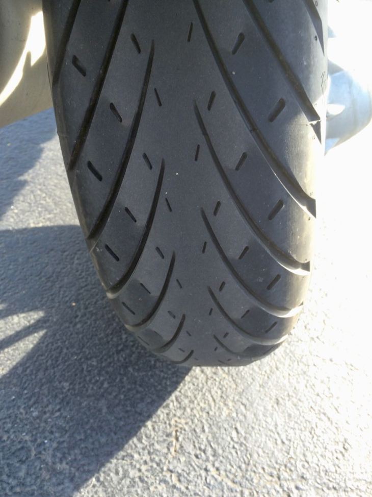
The front tire’s center is wearing flat with a center band that is a little high. These are multi-compound tires, meaning the center will wear more slowly.

At the suggestion of the shop, I had these inflated to 40 psi, which is what I used to run my Pilot Road 4s at when traveling. That should help reduce this unevenness.
I will replace the tires when I get home unless I feel they need replacing earlier. I will continue to watch them closely.
Tomorrow I head into Kansas. I may encounter the tail end of some thundershowers predicted for tomorrow until about 1pm. I will take lunch to avoid the worst of it, letting it finish before I arrive – at least, that’s the plan.
Living a charmed life!
Day 25

Day’s distance / Total distance – 413 miles / 7,146 miles
Temperatures ranged from low 50s to mid 70s. The day began and ended with sunshine, but there was rain which was expected in the middle of the day as I rode into Kansas City. I knew it was coming and my radar app showed approximately how far out I still was when I stopped for second breakfast.

I did get my rainsuit on so I would be ready.
At my next stop, I got to meet Chief, an 8-week old puppy on my next quick break. He was being taken home for the first time. His father is a firefighter, so the breed seemed an obvious choice.

As I reached Concordia, Kansas, the rain started, though slowly with just light showers.
The rainfall was heavy at times, especially as I was leaving Kansas City. On I-70 east, there was a multi-car pile up due to the storm, but westbound traffic was light and continued without incident. I stayed dry on the inside through the entire approximately two hours.
From the radar app, it looks like I missed the worst of it moving mostly between the upper and lower concentrations of rain.

Last night, I made a few changes to my route home. Instead of staying on I-70 through Denver and into the mountains towards Provo, I am diverting north to Fort Collins and then skirting the mountains to arrive at Ogden, Utah.
To rebalance each day’s mileage, and to travel over La Grande Pass in the afternoon instead of in the morning, I canceled my stay in Boise and will overnight in Baker City as my final night on the road.

The change was to avoid having to ride from Denver west during a very cold morning. Temperatures in the mid 20s are really to be avoided on a motorcycle.
The image below is from a website called weatherstreet. It’s a very useful tool providing temperature, precipitation and wind forecasts.

The site is why I knew I would have some rain to ride through today, many days ago.
The 10-day forecasts provides 2am, 8am, 2pm, and 8pm snapshots. The above is the 8am surface temperature snapshot for Monday morning. My original route would cross right through the deep blue section over the Rocky Mountains west of Denver.
So, I routed around it, staying mostly in the green(er) areas. Woo hoo! It will still be probably my coldest day of travel and I will add a layer for additional warmth and put on my warmer gloves.
Looking ahead to tomorrow, I finish crossing Kansas and end up in Fort Collins. I’m not expecting any precipitation and it will still be reasonably warm tomorrow though I may be traveling mostly in the 50s, just like some days up in Canada.
Monday night will be in Ogden, Tuesday in Baker City and Wednesday, if all goes as planned, back in my own bed in Seattle.
Day 26

Day’s distance / Total distance – 471 miles / 7,617 miles
Temperatures ranged from 50 to 75 and cloudy skies gave way to full sun as the day progressed. Winds were relatively mild, at least for Kansas and Eastern Colorado.
Today’s photos are samples of “life next to the interstate.”
Morning skies

Biker flying drone

Wind power

Tracks to Denver

Signs of Kansas

I managed to leave early and make use of the time zone change giving me an extra hour to arrive in Fort Collins just after 3pm.
After getting cleaned up and getting my base layer washed out, I called home and got caught up, checked the weather along my route and then headed out for dinner.
The local Mexican restaurant was recommended and it was delicious, especially the tortilla soup.

I would recommend Hacienda Real if your in Fort Collins’ north end.

Tomorrow I head to Ogden, Utah. It’s going to be a colder morning with temperatures in the 30s, so I’ll be bundled up.
Day 27

Day’s distance / Total distance – 468 miles / 8,085 miles (odometer)
It was cold this morning, with the temperature starting out at 35. That said, it did warm up very quickly and reached the low 70s in Ogden, UT this afternoon. There were clear skies all day.
To prepare for the expected cold, I added an extra layer, including a second pair of socks, pants as a middle layer over my long base layer and under my protective outer layer, and an additional long sleeve fleece middle layer.
I also had the heated grips and heated seat on low most of the day (high is too much under most conditions).
My bike’s fairing blocks most of the cold air on calm days, but cross winds will blow around it. Much of the day my left shoulder felt colder than the right as a result.
I think one key in these conditions is to keep your skin dry. My ldcomfort base layer works wonders in that regard. If you can keep your skin dry, you can stay warm and comfortable. The stuff is expensive but I’ve been using the same two sets for six years. (Yes, it is time to get new ones – lol.)
I’m afraid I only took one picture today, when I crossed into Wyoming this morning.

Wind was a challenge, especially around the greater Elk Mountain area. The electronic traffic boards above the highway warned of 40 mph gusts.
I felt those gusts despite the motorcycle being less impacted than on previous trips when I was using the top case.
Gusts aside, wind was buffeting me and the bike most of the day, though after Rawlings it was more even and easier to manage.
For non-riders, when a motorcycle is hit with a cross wind, the bike cants into the wind. This means you keep going straight but your leaned over, sometimes leaned over a lot! It takes some getting used to and, for me, is not enjoyable.
High winds also buffet my helmet. After a few hours I end up feeling like I imagine a boxer might feel – just plain beat up around the head and shoulders.
The wind, too, was expected. It’s the midwest, after all. No long distance rider is going to escape wind, rain, cold days or fog for very long. It’s all part of the journey.
The secret is to be prepared.
My route, modified yesterday, now takes me from Ogden, UT all the way to Hermiston, OR in an effort to avoid any possibility of getting caught on the wrong side of any overnight snowfall north of Baker City.
In that vein, a good friend and fellow long distance rider told me about another weather site (and app for your phone) called windy.com. Similar to weatherstreet.com but much more polished.
That site shows the showers and wind I’ll be riding through tomorrow. I captured this screen shot of the Baker City area at 3pm, my expected arrival time in the area.
The blue areas are expected precipitation. Snow showers may occur in the mountains on either side of my route, but you can see temperatures (shown in the image) to be in the 40s and 50s.
Deadman Pass, located between Pendleton and La Grande, will be windy and possibly rainy around 5pm. Total expected rainfall is relatively light at under .07 inches per hour

Tomorrow will easily be the longest ride of this trip, over 550 miles. I’ll get an early start, be layered up for a cold morning and have my Frog Toggs at the ready for expected afternoon showers.
My penultimate day of the trip will be throwing everything nature has at me. Stay tuned!
Day 28

Day’s distance / Total distance – 542 miles / 8,627 miles
The temperature this morning at the hotel was 45. The skies were clear and the air was still.
I traveled north towards the Idaho border and crossed it almost exactly an hour later.

Not all states have a place to pull off the road at these signs. I think they should. Just sayin’ 🙂
I stopped at the first rest stop in Idaho to warm up. Luckily the building was heated. I had the yogurt I brought from the hotel breakfast bar.
Temperatures in general warmed up pretty quickly but it was hardly linear. The thermometer on the bike fell as low as 31 and would vacillate between freezing and the low 40s often, depending I suppose on the local terrain and its features. It reminded me of spring in Seattle – you get a nice week of weather in February and then it gets cold again, then repeats the cycle through the end of June.
The speed limits were 80mph most of the way today, so I was able to cover ground pretty quickly.
My next stop was in Jerome, Idaho, for coffee and second breakfast for me and fuel for the bike.

Will was keeping an eye on the weather and we touched base often. It seems I had a clear cell signal most of the day.
I crossed into Oregon (which does not have a safe pullout to take a picture of the border sign – just sayin’ ) before stopping again near Ontario (I think). I needed fuel again. While I was filling up the bike, I noticed some food trucks across the street. One was making Mexican food so I stopped.

I ordered and quickly consumed three delicious tacos al pastor.
When I was finished I noticed two other bikers had pulled up to the food truck next to mine. One was riding a KTM and geared up in Klim, the other a Harley and geared up in leather chaps and jacket.
I had to ask if they were friends or what. You don’t usually see these two types riding together. They laughed and said they were father and son.
They came from the north and confirmed some strong winds and some rain south of baker city.
As I continued my quest north, I could see the clouds over the mountains and the rain that was in my future.

It wasn’t long (near Lime, OR) before I pulled off the highway to put on my Frog Toggs.

It was only the next exit where the road was wet from earlier showers but it would not start raining for about 10 miles more.
The rain wasn’t as hard as what I experienced in Kansas City but it was more than predicted.
Temperatures fell from the mid 60s to the low 40s as I approached the edge of rainfall. North of Baker City, the rain stopped. Deadman’s Pass was clear and the road surface mostly dry.
I thought once out of the Blue Mountains it would be smooth sailing but I was hit by some strong winds between Pendleton and Hermiston. At first they were coming from my front quarter, so were not too hard to manage. But as I got within about 20 miles of my hotel, they became cross winds, coming at me from the side. They were as bad at this point as anything I experienced the day before.
I guess I can count myself fortunate. Though I had a cold morning, a rainy afternoon, and strong cross winds to finish, I did not have any two at the same time. 🙂
Tomorrow’s ride to Seattle will be along the Columbia River to Vancouver, WA, then up I-5. Snoqualmie Pass had snow today and will not be safe, so I’m taking the alternative.
I should be home by mid-afternoon. As is my habit, I usually am a day late on my final blog entry. I have to shop for groceries and get some other life maintenance items done. Look for my final blog entry on Thursday.
Thanks for following this far. Stay tuned for my final post and, in a few days, some reflections on this trip and its design.
Day 29 (final)

Day’s distance / Total distance (final) – 357 miles / 8,984 miles
Temperature ranged from low 40s to upper 50s. The skies were clear and crisp in Hermiston but a bit hazy later on as the air from the coast brings moisture.
I haven’t ridden Hwy 14 the entire 180 miles from Pendleton to Vancouver, WA very often, maybe once. It’s quite scenic and varied as the river narrows through the Gorge area to the west.

I stopped for a coffee and pastry around two hours into the ride. It was not warm but tolerable if I took a break and stood in the sun. I had a maple bacon scone that was delicious! The latte was hot, and that helped warm me up, but the taste wasn’t to my liking. 😦
During my ride through the Columbia River Gorge Scenic Area along Hwy 14 on the Washington side of the water, the odometer flipped 87,000 miles!
I stopped at Drano Lake to mark the milestone.

At the end of the trip, it read 87,187 miles on the clock. That’s a lot of journeys through the US and Canada. 🙂
Why the rush?
Recall that I’ve traveled from Columbus, Ohio to home in six days. I altered the route and sped up the timetable several times as a cold front was arriving in the northwest.
That cold front arrive the morning after I returned home. Here’s what it looks like, from a temperature perspective (blue is freezing – no bueno).

Even one day later would have me in Baker City, where it was below freezing mid morning. And I would have had to cross over Deadman’s Pass where it would certainly be colder with the possiblity of patches of snow / ice on the roads.
So, it was worth pushing, and was informative with regard to the design of including fast travel days. Just being grateful I was able to move across the entire map area shown in a week.
In the coming days, I’ll post some reflections and add the entire trip under the Completed Adventures section of the site.
Reflections

My view east the morning after arriving home (through telephoto lens).
A crisp, cold morning, mist over the lake and an orange glow backlighting the Cascade Mountains reminding me that I live in a beautiful area, one rivaling many of the places I visit.
It feels great to be home. I feel great having successfully finished another motorcycle adventure!
What was the highlight of the trip?
Well, besides getting home safe and sound which I always think of first, you need to be a bit more deliberate here. Four weeks is a lot to evaluate.
The Cabot Trail
Turnaround points in a journey generally represent a sense of accomplishment in combination with an interesting road to ride or scenic place to overnight.
In that regard, I would say the first day riding the Cabot Trail was spectacular, with good weather and sunny skies on the leeward side, and dramatic, with a finish in the rain starting while I was riding the windward side of the trail an hour out from my motel with the sun setting and construction across the entire highway surface between me and my bed for the night.

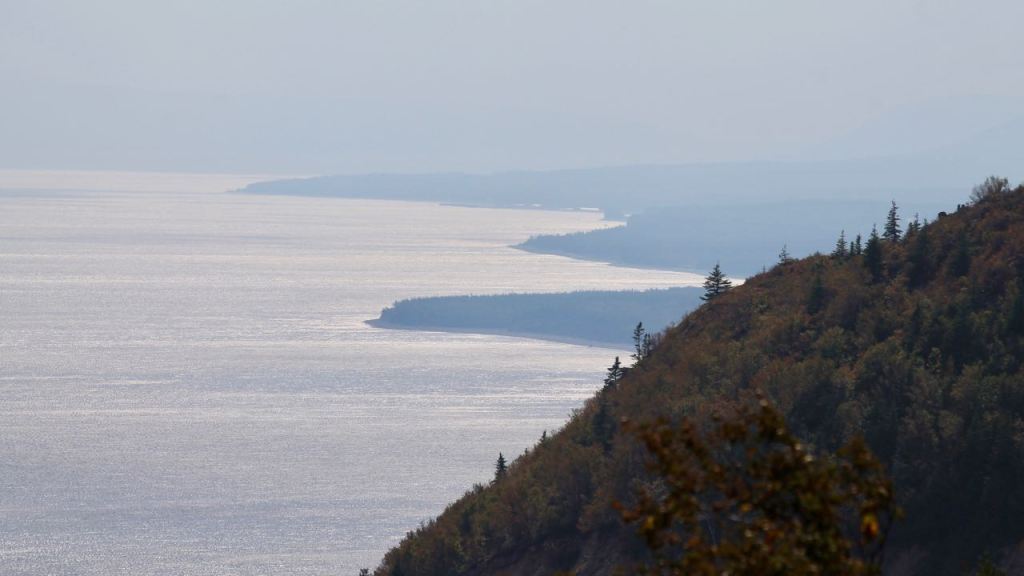

Oh, and a nice bucket of mussels thrown in with meeting a new friend for the second time in a day. Whew! So that was pretty memorable.

Lake Superior
The Lake Superior Provincial Park is really spectacular. I traveled from the north entrance in to see some of the best views right away!
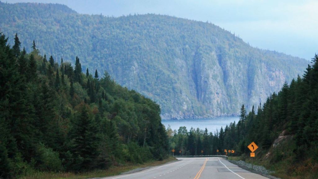
Some of the ride east of Thunder Bay presented amazing views of Lake Superior as well, and this unexpectedly so.
Great roads
I have to say Pennsylvania State Route 144 was the call out road to ride. I found zen among the challenges of rain and fog.
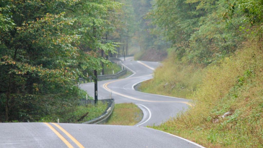


In second place was West Virginia Hwy 26 from Woodsfield south to Marietta. A mostly clean (front tire slipped across gravel once) little used slice of heaven. This ride was in good weather and dry roads.
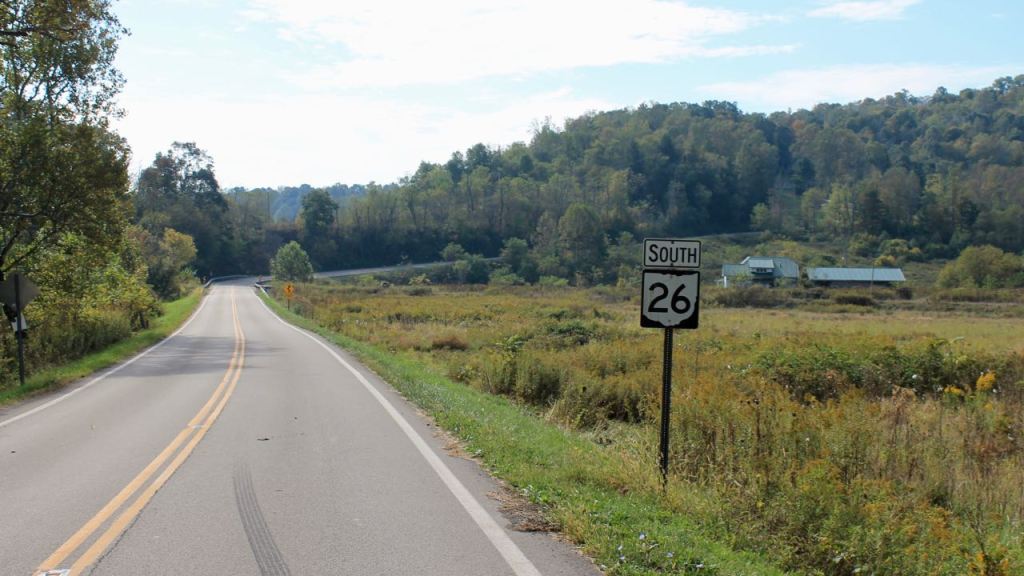

How many miles a day did I ride?

The trip seemed to fall into three legs, or phases, including; the Canada crossing culminating in the Cabot Trail ride, a more leisurely exploration of the northeast US between Maine and Ohio, and an interstate dash home.
The last week felt like a real push, averaging about 450 miles a day. In contrast, the two-week crossing of Canada felt more comfortable at 345 miles a day.
I think there are some things I could do to make long days more comfortable and less stressful.
Mods include:
- a taller wider wind screen ($$)
- round convex mirror inserts ($)
- a more comfortable seat ($$$)
- new suspension ($$$$)
- new outer gear ($$$)
- warmer winter gloves ($$)
- sport boards to replace pegs ($)
- a quieter helmet ($$$)
With the end of my extended service plan (warranty) coming next Spring, I look forward to making suspension changes early next year. That’s my thinking right now – that I’ll continue to ride this motorcycle and begin to do at least the fluid changes myself, if not (eventually) all routine maintenance myself.
The original clutch remains in good shape after 87K miles. The manager suggested that if she doesn’t sit for extended periods of time, and I could go to 150K before it wears out. We’ll see about that.
Point is this – this motorcycle works well for me. It fits well, rides well and treats me well, aside from her expensive tastes (in service dollars), she seems to be in good shape.
The new suspension will be serviceable and built to spec, set up specifically for my weight and long-distance travel preferences.
How much did I spend?
Details below but the whole trip cost about $4,875 or just over $1,200 per week, including food. See the details below.
For planning purposes, I generally budget $1,200 per week, not including food. This trip was well within that budget largely because of the hotel promotions leading to free nights.
The amount generally budgeted per week has increased since I began traveling in 2014, when I budgeted $1000 per week. Lodging costs have increased and I camp less often, or in this case camp not at all.
Lodging Costs – $600 / week

During my 28 nights, I was able to get two free nights at Choice Hotels from a seasonal rewards promotion and one free night at a Best Western for a different promotion. I also received refunds from a Hampton Inn and from the Wheeling Casino that were not promotion related.
This kept lodging expenses lower than expected at $2,349 or just under $84 per night, including the free nights in the average.
Fuel – $125 / week
I spent approximately $500 on fuel for this 9,000 mile trip, roughly $55 per 1000 miles or $125 per week in this case.
I get about 50 miles per gallon, for those curious. Oh, and the bike uses 89 to 91 octane fuel – mid grade or premium.
Food – $200 / week
My food spend totaled approximately $750 or a bit less than $200 per week.
For budgeting purposes, I keep a separate food budget for the year, of $600 per month, including any refreshments (wine, beer, alcohol). I generally stay below that at home and go over while on the road.
Tires – $150 / week
I wont need another service this year, but will need to replace the tires.
I’ve ordered the next set, which cost roughly $400 for the set and will cost approximately $150 to have mounted and balanced. This trip used up the tires completely so we’ll say their costs come out to about $60 per 1000 miles, or $150 per week, just a bit more than fuel.
The Roadtec 01 HWMs lasted longer than I expected. The center compound is a tough one. I have about 10K miles on this set. Profiles are pretty flat now on both the front and the rear.
The new set will be the Road 5 GT tires, replacements to the Pilot Road 4 GTs I’d been running for years.
I’ll compare the Roadtec 01 to the Road 5 GT and see which I prefer.
Service – $175 / week
The service cost roughly $725, or just about the same as food. This was the level II service, which generally is more expensive than a level I and includes all fluids except brakes, filters, plugs and valve adjustments.
Rounding down, let’s call it $175 per week.
Riding Interstate Highways
So, yeah. How was all that?

A mixed bag but purpose built and supported.
Purpose of the interstates
Interstates are efficient and generally well supported. If you need to cross the country quickly, the interstate system is the way to go.
Want to get from Columbus, Ohio to Seattle, Washington is six days while limiting the elevations to avoid snow showers or worse? Turn to our interstate system.
Living on interstates
To share the life I found on the interstates, I’ll focus on interactions with semi-trucks, high winds, road debris including road kill, and high speeds – a catalyst for increasing the risk in each of the prior factors.
Semi-trucks
Interactions with semi-trucks increase significantly on the interstates. Stay out of their way whenever possible, pass as quickly as possible, look far ahead to anticipate their actions.
Road kill and other debris
Pennsylvania seemed to be the worst, but there was a lot of deer and raccoons along the interstates in many locations. I see debris of all types in traffic lanes – shredded tires are most common, but I’ve seen blocks of wood to a whole pallet, and just this trip saw something vaguely shaped like a car door. Be aware of how far ahead you are looking, but don’t forget to check your lane, too.
High Winds
I made a route change to avoid excessively cold conditions. Riding into a cold front’s arrival put me into high wind territory.
I opted to not use the top case this trip. I wasn’t camping. And, without the extra case, I would lessen the impact of strong winds.
I call my ride a lightweight touring motorcycle. It easily maintains any legal speeds in the country, even facing head winds and using a big fairing to protect me from the wind pressure generated at those speeds.
That was a really great decision. Several days of cross winds towards the end of the trip brought home the sensibility. Whew!
Lack of a fullness, perhaps a limited sense of joy
Let’s face it, my mental processes underwent a change after successive days faced with the sameness of the interstates.
Instead of focusing on the ride and the next corner, as if I was riding SR 144 in Pennsylvania again, or focusing on finding a perfect way to frame a picture of the place I find myself in, I would focus on the clock and the miles remaining.
Interactions were more limited and less personal, by design, to keep you speeding along to your destination.
Food choices that were most easily accessed were also limited to a few staples of that realm – Mickey D’s, Subways, Tim Horton if in Canada.
